Average end to the year but fun one day
Monday, 27 December 2021

Average end to the year but fun one day
Monday, 27 December 2021
Nowhere near as good as last week but there'll be one day worth aiming for a paddle.
Nowhere near as good as last week but there'll be one day worth aiming for a paddle.
Next week offers a major pattern change for the QLD coast as a dominant high pressure system drifting E of Tasmania sets up a strong high pressure ridge along the coast.
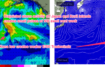
W/NW energy from severe gales between Hokkaido and Honshu is expected to build surf Mon with 13-15 second period energy seeing wave heights rise to Hawaiian 4-5ft. Peaking Tues in the 6ft+ range before easing during the day. Lighter E’ly trades suggest an excellent day of surfing.
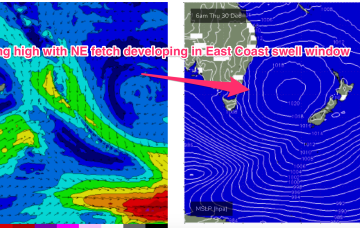
NE windswell looks to build from Thurs, as a dominant high drifts towards New Zealand, allowing winds from the western flank to form a coast hugging fetch south from Jervis Bay.
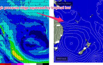
Models have invested in the start of the Northern Australian Monsoon (NAM) as the year ends, suggesting a tropical low tracking across the Northern Territory into the Gulf of Carpenteria and then across Cape York Peninsula into the Coral Sea towards the end of next week.
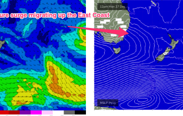
There's an upgrade to the swell due Sunday but winds aren't looking any better. Try and seek some protection.
The run of active surf has come to an end and we've got a very slow forecast period ahead. Hopefully more action into the New Year.
As discussed on Wed, we see a major pattern change next week after the troughy, doldrums pattern this week.
The past week of fun waves across the Mid Coast will be a distant memory on the weekend and early next week with the swell bottoming out along with strong winds from the south-eastern quadrant.
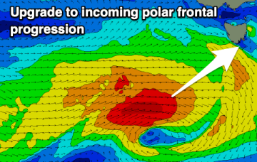
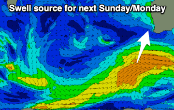
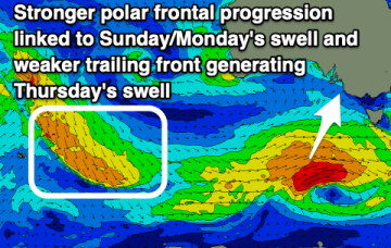
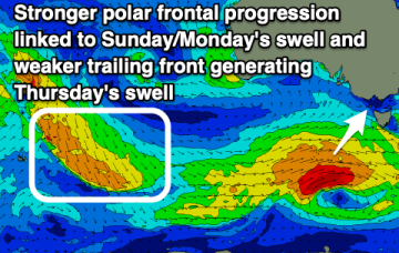
There's been an upgrade in the strength of a frontal progression bringing swell over the coming days but winds will spoil it.