Poor surf outlook to hold steady for some time
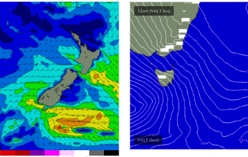
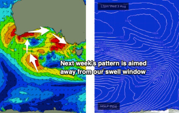
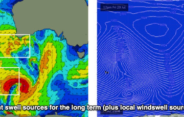
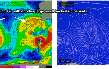
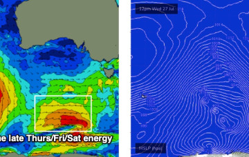
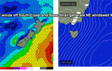
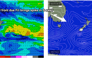
In essence, the storm track is aimed pretty much everywhere except for the Vicco and Southern Tasmanian swell windows.
High pressure rapidly moves off the NSW Coast early next week, driving a N’ly flow off the South Coast into Bass Strait. Unfortunately, this fetch is now disjointed and rapidly shifts to the NW through Mon.
The long term outlook remains unchanged for Victorian surfers. You’re not gonna be happy.
A much quieter period ahead as weak, spring-like conditions establish from Monday.
No great action on the radar after this weekend as spring-like N'ly pattern establishes.
We’ve got some new swell inbound over the next few days, and conditions are looking pretty good too.
Very active Indian Ocean storm track continues with fronts and deep lows forming near Heard Island before being steered NE towards WA as decaying fronts. That's seeing multiple large swell events over the f/cast period.
More swell is due over the coming days however conditions are looking pretty ordinary, thanks to the passage of two fronts - one tonight and the other Thursday night.
We are now close to the end game as the low which started off the CQ Coast in the Coral Sea expends it’s last energy off the bottom of the South Island New Zealand, with a fetch still well aimed for East Coast Tasmania.
One of the features of this current La Niña phase has been long-lived swell events as low pressure lingers in the Tasman Sea. This current event is typical of that pattern. We are now close to the end game as the low which started off the CQ Coast in the Coral Sea expends it’s last energy off the bottom of the South Island New Zealand.