Tiny weekend, possible cyclone swell next week
Friday, 1 December 2023
Tiny weekend, possible cyclone swell next week
Friday, 1 December 2023
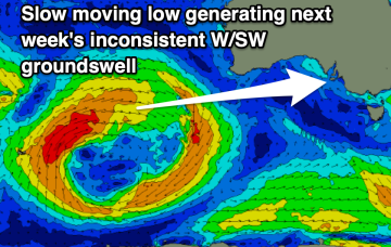
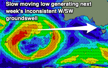
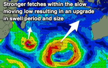
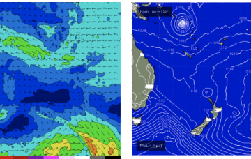
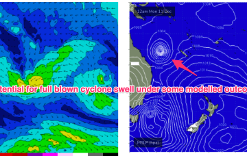
Further ahead and some weather model runs are starting to look pretty damn juicy with respect to a developing TC in the South Pacific moving into the Coral Sea next week. Still very early days but a full blown cyclone swell is now a definite possibility, possibly as early as late next week and into the weekend.