Make the most of the surf today
Friday, 24 November 2023
Make the most of the surf today
Friday, 24 November 2023
Get in across the beaches today and tomorrow ahead of a poor, windy period of surf.
Get in across the beaches today and tomorrow ahead of a poor, windy period of surf.
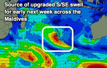
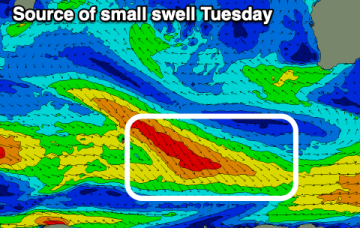
Indonesia remains small, while the Maldives will provide a good swell early next week.
The coming days will see fun surf with workable winds, stormy and onshore into the weekend.
It’s a weak synoptic pattern with no major swell sources and especially light winds across the Coral Sea.That will keep this f/cast update short- no surf to speak of.
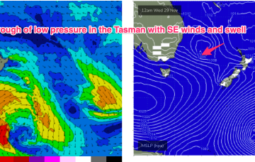
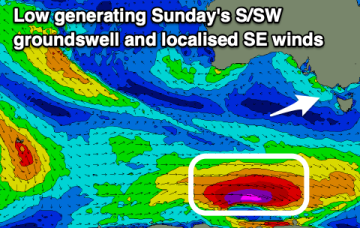
That trough then deepens o/night Sat into Sun with a building trend in S-S/SE swell under fresh/strong winds from the same direction.
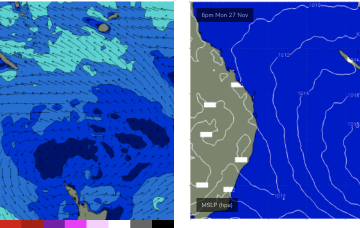
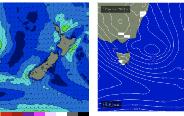
It’s a weak synoptic pattern with no major swell sources- a passing front weakens as it traverses the Tasman, leaving an off-axis fetch parallel with New Zealand. There should be enough minor swell sources of no real quality to stay wet through the short term.
There's no quality swells on the cards for the period as the poor outlook persists.
A poor run of S/SE winds is due over the period, swinging west only for one morning.
It’s a weak synoptic pattern with no major swell sources- a passing front weakens as it traverses the Tasman, leaving an off-axis fetch parallel with New Zealand. There should be enough minor swell sources of no real quality to stay wet through the short term.
Tomorrow won't be great but Friday should see improving surf on the beaches.