Flukey period of swell and winds
Monday, 15 January 2024
Flukey period of swell and winds
Monday, 15 January 2024
The coming period isn't reliable for surf but savvy surfers might hunt out something.
The coming period isn't reliable for surf but savvy surfers might hunt out something.
A SE surge currently working it’s way north now looks to stall and dissipate before it reaches water north of Fraser Island with only tiny/small surf expected for CQ.
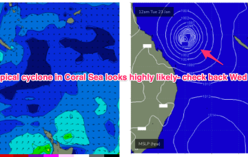
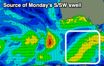
Very active pattern to start the week with a large high (1029hPa) moving E of Tasmania and active Monsoon Trough extending in to the Coral Sea and an approaching complex low well to the SW of Tasmania.
There's nothing expected for the Mid this period while there should be windows down South with a sizey S'ly swell.
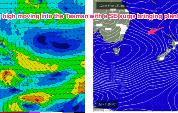
Very active pattern to start the week with a large high (1029hPa) moving E of Tasmania with a SE surge enhanced by a trough along the leading edge of the high, and active Monsoon Trough extending in to the Coral Sea and an approaching complex low well to the SW of Tasmania. Add in a long tradewind fetch in the South Pacific. All these features are potential sources of surf in the short to medium term.
We've got a dynamic week of waves and weather but both coasts should provide options.
Very active pattern to start the week with a large high (1029hPa) moving E of Tasmania with a SE surge enhanced by a trough along the leading edge of the high, and active Monsoon Trough extending in to the Coral Sea and an approaching complex low well to the SW of Tasmania. All these features are potential sources of surf in the short to medium term.
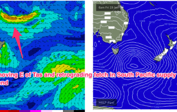
The resulting SE surge up through the Tasman into the Coral Sea generates plenty of swell as the fetch spreads out across the Tasman. We should see surf build Tues into Wed with plenty of fun surf.
Strong onshore winds and some weak swell for Sunday, much better Monday as it eases.
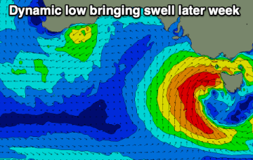
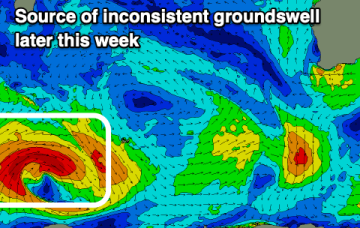
A major swell is possible from Wed as a deep low may form in a a trough line either E of Tasmania or off the Gippsland coast, possibly moving up off the NSW South Coast - enhanced by extra warm water pooled up in that region.