Back to small summer grovel surf with some pockets of good winds at least
Wednesday, 24 January 2024
Back to small summer grovel surf with some pockets of good winds at least
Wednesday, 24 January 2024
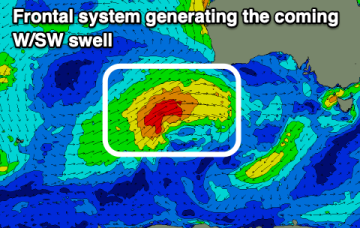
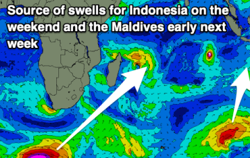
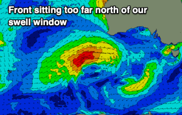
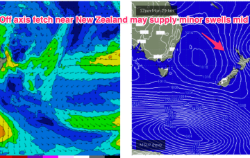
Absent that, with weak high pressure in the Tasman we’ve only got marginal, local wind swells to keep wave zones active this week, and into next.