Windy week with a couple swell pulses
Monday, 27 January 2025

Windy week with a couple swell pulses
Monday, 27 January 2025
The coming week is a bit more miss than hit thanks to less than favourable winds at the peak of swell.
The coming week is a bit more miss than hit thanks to less than favourable winds at the peak of swell.
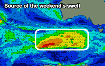
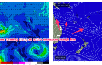
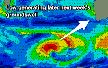
Multiple low pressure systems are suggested on long range model guidance, potentially tropical cyclones which could deliver large E’ly swells.
Once the change hits today, it'll be all over until the weekend.
Longer term is starting to look more dynamic as the tropics finally starts to fire up. Multiple low pressure systems are suggested on long range model guidance, potentially tropical cyclones.
An early evening change today will be followed by poor winds right through until the coming weekend.
Either way, it’s looking like our eastern swell window is about to get into the swing of things and finally resume its regular summer programming.
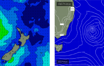
Today’s strengthening southerly winds are related to a developing Tasman Low that is poorly aligned within our swell window, and tracking unfavourably to the east.
The coming period is active, you just have to work the local winds.
The coming outlook is less favourable but there should be a couple of windows to fit a surf in.