Fun round of NE windswell from Sun, peaking Tues
Friday, 31 January 2025

Fun round of NE windswell from Sun, peaking Tues
Friday, 31 January 2025
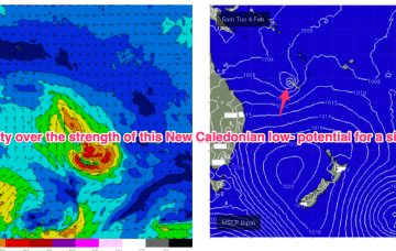
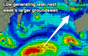
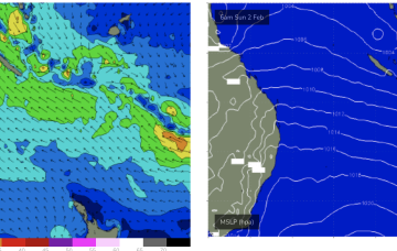
A more classic looking summer chart to start next week with high pressure in the Tasman and low pressure centres near New Caledonia and in the South Pacific slot, with a healthy E’ly tradewind fetch extending across most of the Central and Southern Coral Seas and NE winds in the NETas swell window.