Multiple large S swell pulses incoming, becoming very sizey over the weekend

freeride76

Multiple large S swell pulses incoming, becoming very sizey over the weekend

freeride76

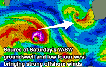
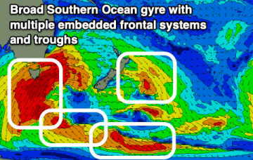
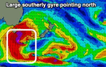
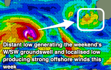
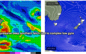
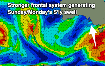
Strong high pressure support from a 1033hPa elongated high in the Bight is providing tight pressure gradients for the multiple fronts spinning off the gyre. That will lead to numerous over-lapping S’ly pulses over the coming week with a general step-ladder effect expected at least through to Mon. A general offshore flow will accompany these pulses as the fronts drive W’ly biased winds across the temperate to sub-tropical East Coast.

Extended round of S swell pulses ahead, sizey over the weekend

freeride76

Extended round of S swell pulses ahead, sizey over the weekend

freeride76

A strong node of the long wave trough is steering fronts into the Tasman Sea while a negative phase of the SAM (Southern Annular Mode) is bringing the southern Ocean storm track into a more northerly latitude, closer to the Australian continent and Tasman Sea. Both those factors will drive a series of strong cold fronts this week, with a step-ladder effect likely as each subsequent front works on an already charged sea state. 

Cold, onshore week

Craig

Cold, onshore week

Craig

Persistent onshore winds with only short periods of lighter, cross-offshore breezes and moderate pulses of southerly swell.