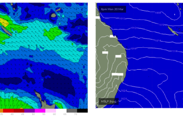
Coupla options to pick and choose from
Monday, 20 March 2023

Coupla options to pick and choose from
Monday, 20 March 2023
Early Tuesday still has a brief window of options for keen surfers.
Early Tuesday still has a brief window of options for keen surfers.
It’s a real shame about these local conditions, because there’s plenty of swell due on Tuesday at least, sourced from an active frontal progression late last week and into the weekend.
Looks like a poor couple of days ahead for the Torquay region, mainly due to local winds.
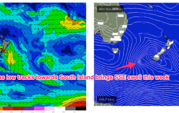
Compared to Fridays notes the front/low in the Southern Tasman is a stronger system while the tradewind pattern is weaker and more disjointed. That will see S quadrant swells dominate through most of the week through temperate NSW, with a smaller tradewind swell signal north of Coffs Harbour.
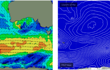
A steady conveyor-belt of fronts below the continent are generating a new round of groundswell.
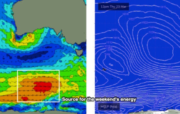
There's only a brief window of opportunity for surfing this weekend.
Strong SSW-SW swell from a front which tracked past Heard Island generating a wind swathe of seas in excess of 20ft as it passed under the state today will build in mid morning in the SW, a bit later in Perth/Mandurah.
Also on the radar next week we’ll be watching a low pressure system in the Coral Sea which has been lingering for days as a diffuse system. There looks to be more organisation later next week, possibly with a S-SE recurvature if the system intensifies into a tropical cyclone.
A high quickly slips E of Tas later Mon with NE winds developing and a potential NE windswell through Tues and Wed as winds feed into an inland trough.
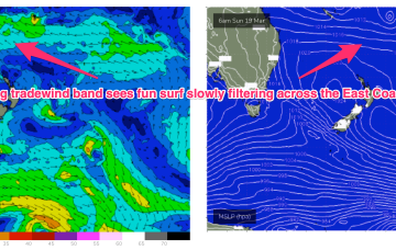
All eyes out to the Pacific swell window this week with a typical late Summer/early Autumn pattern setting up. Low pressure centres well to the East of Fiji (near American Samoa), west of Fiji and NW of New Caledonia will all chug away on a long tradewind belt setting up presently and enhanced by a dominant high pressure cell moving SE of Tasmania early next week.