Nice waves coming up for the South Arm
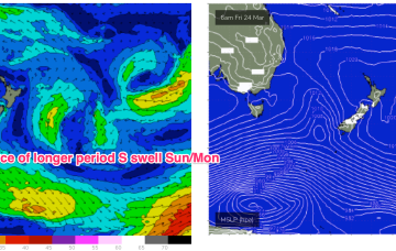
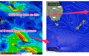
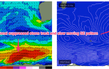
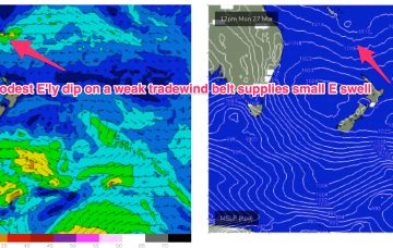
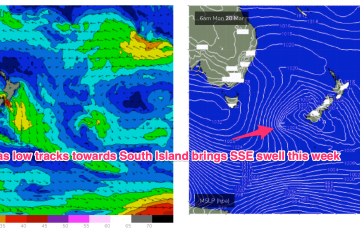
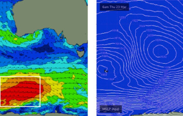
A series of overlapping swell trains will start to filter in on Thursday afternoon, with a gradual increase expected over the coming three days.
In the south a small trough of low pressure off the Gippsland coast is aiding a N-NE flow through temperate NSW with a S’ly change on the radar for tomorrow. The remnants of a low near the South Island are now dissipating after a final flare up yesterday.
The bulk energy from the upcoming Southern Ocean sequence will build further into Saturday, reaching a peak on Sunday.
Average waves are expected to finish the week though the trend will be up, which is good.
In the Coral Sea a monsoon trough remains active with a persistent but unspectacular trade-wind flow maintaining a small fun E swell signal north from Port Macquarie. The remnants of a low near the South Island are now dissipating after a final flare up yesterday.
High pressure has now moved into the Tasman, weakening rapidly as it does so. In the south a small trough of low pressure off the Gippsland coast is aiding a N-NE flow through temperate NSW. In the Coral Sea a monsoon trough remains active with a persistent but unspectacular trade-wind flow maintaining a small E swell signal. The remnants of a low near the South Island are now dissipating after a final flare up yesterday.
This “stuck” synoptic pattern will favour semi-protected waves in the SW under a regime of small SW pulses this week, generated by a zonal suppressed storm track, augmented by some smaller, long range WSW swell generated in the far western Indian Ocean.
Tradewinds have been active through the Coral Sea, anchored by a small E’ly dip SW of New Caledonia. With the tradewinds fully established we are seeing a fully developed sea state through the Central/Southern Coral Sea which will keep fun waves chugging along through this week.
A trough in advance of a strong high pressure cell and deeper Southern parent low is bringing a fresh S’ly flow to Eastern Tas today, with conditions rapidly shifting gears tomorrow as the large high drifts East of the state.
Compared to Fridays notes the front/low in the Southern Tasman is a stronger system while the tradewind pattern is weaker and more disjointed. That will see S quadrant swells dominate through most of the week through temperate-sub-tropical NSW, with a smaller tradewind swell signal north of the border being the dominant swell train.