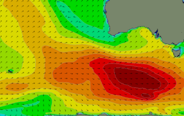
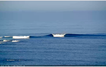
Solid but onshore tomorrow, fun from Sunday
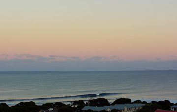
Nothing special tomorrow even with the sizey swell due to the local winds, much better from Sunday.
Flukey swells and winds from distant and tricky sources. A spring outlook with rain on the way.
We've got one more solid swell to come this period before things quieten down into the end of the month. Winds look to swing back to the north-east from Sunday.
We've got one more large, windy swell on the way but conditions will improve rapidly as it starts to ease, opening up fun options on the beaches.
Pressure gradients tighten on Tuesday as a cut-off mid-latitude low in the Bight approaches, with N’ly winds starting to freshen along the NSW South Coast and adjacent waters. This N’ly fetch is expected to be a useful swell source for NETas.
This allows a broad, but weak area of Tradewinds to develop through the Coral Sea, with just enough coverage in the crucial area SW of New Caledonia down to the Fraser Coast to allow some useful tradewind swell to build through Tues and Wed.
Lots of swell with periods of good winds, you'll just have to work the size pulses and swings in wind.
Below the continent, a very active Southern storm track is continuing to generate large seas with a few pulses of long period swell expected from this source.
A fun end to the week ahead of a trickier period owing to funky winds and mixed swell sources.
Varying winds this period from all degrees of the compass, but workable across both regions at times.