Large and stormy E swells Ahoy as low moves off Far Southern NSW
Wednesday, 29 November 2023
Large and stormy E swells Ahoy as low moves off Far Southern NSW
Wednesday, 29 November 2023
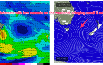
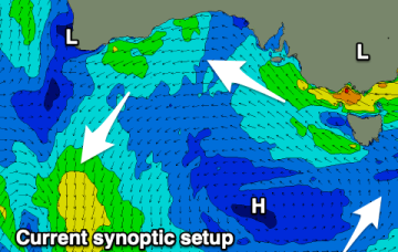
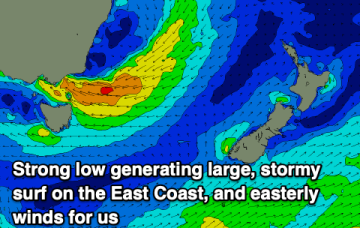
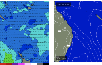
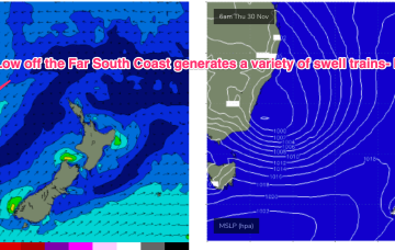
A dynamic weather event is underway as a complex inland low approaches the Far South Coast of NSW, expected to enter the Tasman Sea tomorrow. A moist NE-E/NE infeed into the low is generating plenty of rain (heaviest falls on the South Coast) and building swells from the same direction, focussed on NETas. We’ll see large surf develop across NETas as the low moves offshore tomorrow.