Lots of southerly swell inbound

Sydney, Hunter and Illawarra Surf Forecast by Ben Matson (issued Monday 3rd August)
Best Days: Tues: solid S'ly swell with good winds (except possibly the Hunter, early). Easing steadily Wed but nice and clean everywhere. Thurs/Fri/Sat: solid S'ly swell, with periods of good winds (Fri still the pick at this stage).
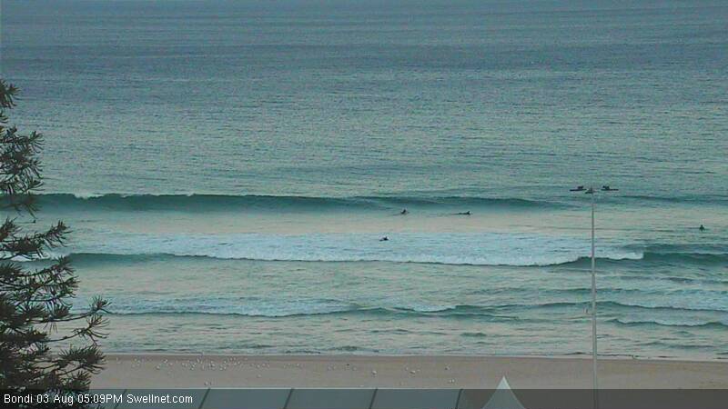
Recap: Last week’s southerly was small by Saturday morning and eased slowly throughout the weekend, and Saturday even dished up a small NE windswell at swell magnets. Today’s seen a minor new southerly swell fill into the coast with 1ft to occasionally 2ft sets at south facing beaches (see screen grab from our Bondi surfcam below, taken just after 5pm), and not much elsewhere.
This week (August 4 - 7)
A deep low south of Tasmania - responsible for snow down to sea level there this morning - is tracking up into the Southern Tasman Sea, and generating a new swell for Southern NSW. This system has been slightly upgraded since Friday’s model runs, with stronger core winds (although not very well aimed towards our coast), so we’re looking at marginally bigger waves than previously thought.
The swell should be well and truly in the water on Tuesday morning, with sets expected to reach a peak in the afternoon around 4-5ft at south facing beaches, and bigger bombs in the 5-6ft+ range across the Hunter. Conditions are looking pretty good in most areas as the associated front should clear quickly to the east, resulting in light variable winds for much of the coast. The only concern is the Hunter region which may fall victim to a lingering southerly flow early morning (which should clear through the afternoon).
Keep in mind that beaches not open to the south will be considerably smaller. Along with the afternoon peak in size, we may also see a late swing in the wind to the west as another front approaches the region, so golden light (3-4pm) should be well worth the effort for surfers and photogs alike.
On Wednesday we’ll be between swells. Early morning should still have some 2-3ft sets at south facing beaches (a little bigger in the Hunter) and it’ll be clean with offshore winds but it’ll become very small by the afternoon.
The next front will enter our southern swell window - east of Tasmania - later Wednesday and will provide a steady increase in southerly swell through Thursday, peaking late and probably persisting through Friday as a series of secondary fronts race around the western flank of the Long Wave Trough (which should be positioned nicely in the Tasman Sea by this time), generating additional energy.
At this stage Thursday will probably start off small but should reach 4-6ft at south facing beaches by the end of the day, with bigger waves across the Hunter. This is down on Friday’s forecast estimates, mainly due to a weakening of core wind speeds within the associated fetches. They’re also slightly more off-axis (of our swell window) than previously modelled. But the length, width and duration - including the NE track of several embedded lows through an active sea state, possibly resulting in a ‘captured fetch’ scenario - all remain very positive attributes. I'll have more confidence on the eventual surf size by Wednesday.
Thursday’s winds look reasonably good, although we will probably see a freshening SW thru’ S/SW tendency at some point into the afternoon, which may create some problems at exposed beaches (particularly in the Hunter). Most of the morning should see W/SW winds though and clean conditions at most coasts. Unfortunately, this will coincide with the smallest surf of the day.
Friday’s persistent southerly swell - somewhere between 4ft and very occasionally 6ft at south facing beaches (bigger in the Hunter, smaller elsewhere) - should see better winds with a light to moderate W/SW flow across most regions. Even locations not open to the south should see plenty of waves these days, so it’s looking like a strong, active finish to the week.
This weekend (August 8 - 9)
On Friday I discussed a longer polar fetch associated with the tail end of this long wave pattern that was expected to generate more southerly swell for this weekend. This scenario is still expected to eventuate however the entire storm track has been focused a little more clockwise (that is, aimed NE instead of N/NE), which is slightly out of alignment of our primary south swell window.
Nevertheless, we are looking at a steady steam of quality south swells from Saturday through into the first half of next week. They won’t be quite as big as previously estimated, and as this stage local conditions are still unsure as some models are suggesting we’ll see a couple of weak fronts clip the coast over the weekend (maintaining a S/SW airstream across the region).
At this stage wave heights should fluctuate somewhere in the 3-5ft range at south facing beaches both days - bigger in the Hunter and smaller at beaches not open to the south - but I’ll revise all of this in Wednesday’s update.
Next week (August 10 onwards)
Aside from the last round of south swell (from the polar fetch mentioned above) due across the region on Monday, it’s looking like a slow week of waves next week.
With the Long Wave Trough clearing to the east over the weekend it appears that our run of southerly groundswell will come to a halt sometime early-mid next week. As such, we’ll be relying on local weather systems in the Tasman Sea for surf potential during the middle to latter half of next week.
But right now, there’s not much showing on the charts. Tune back in on Wednesday to see if anything has popped up since then.
Comments
hmmm. reasonable south swell and 100,000 people finishing the city to surf. Maybe avoid bondi this weekend... hahaha
A lovely study in refraction. How's that channel tweak up top?
From our Cronulla beaches surfcam: https://www.swellnet.com/surfcams/cronulla-beaches