Smaller surf 'till the weekend; large and windy from Sunday onwards

Sydney, Hunter and Illawarra Surf Forecast by Ben Matson (issued Wednesday 15th April)
Best Days: Thurs AM: small clean waves in the morning. Sun PM: protected southern corners in the afternoon. Mon/Tues/Wed: large to very large but windy surf as a possible ECL intensifies off the coast.
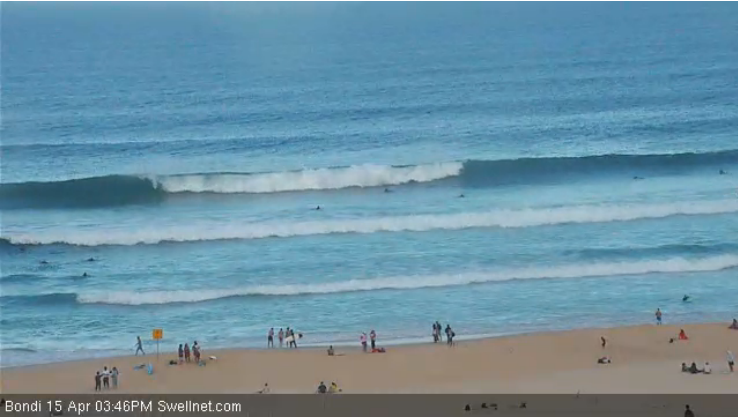
Recap: Pumping S/SE swell both days, easing from 4-6ft at south facing beaches early Tuesday (bigger bombs in the Hunter), down to 3-4ft this morning (again, bigger in the Hunter). Still some 3-4ft sets on offer this afternoon, as per the image below from our Bondi surfcam. Light morning offshore winds preceded moderate afternoon sea breezes both days.
This week (Apr 16 - 17)
The current S/SE swell will continue a downwards trend for the next few days, but it’ll be supplemented by a small secondary pulse from the same direction on Thursday afternoon.
Truth be told, I’m not entirely sure on the origin of this particular pulse as there was no obvious signs of a secondary intensification within the primary Tasman Sea storm track earlier this week; perhaps its source is the re-intensification of the broader system east of New Zealand. This currently extends a fetch of gale force southerly fetch down to about 60S (south-east of New Zealand), however it’s generally poor in alignment for the Australian East Coast so we’re probably seeing minor sideband energy from it.
Nevertheless, set waves will be very inconsistent and south facing beaches will have the biggest surf, with a couple of stray 2-3ft bombs early Thursday becoming a little smaller during the day (I don’t think the new afternoon pulse will amount to much more than 2ft+).
As for winds on Thursday, we’re looking at freshening northerlies overnight tonight but they’re due to veer NW early Thursday morning ahead of a shallow S/SE change pushing up the coast during the day, reaching the Illawarra just after lunch and Sydney mid-afternoon (and the Hunter region late afternoon). So aim for a morning session for the best waves.
Friday looks a bit on the average side. Thursday’s late small S/SE pulse is expected to ease back, and with no other new swell sources we’ll be looking at minor residual energy. A weak trough across the region will direct light to moderate onshore winds about most locations but we should see periods of light variable winds early morning. All in all keep your expectations low.
This weekend (Apr 18 - 20)
No changes to the weekend forecast as per Monday’s notes.
We’ve got small residual swells and freshening northerly winds on Saturday ahead of a gusty southerly change on Sunday morning that should whip up a sizeable short range swell by the end of the day. Wave heights will initially be only small early morning but by late afternoon, south facing beaches could be a windy, messy 6-8ft.
Due to the short swell period and acute southerly direction, wave heights will be considerably smaller at protected spots. However these locations won’t really ave anything worthwhile until about lunchtime at the earliest (maybe not even until mid-afternoon).
Either way, that’s probably the pick of the weekend - windy but building south swells at protected locations on Sunday afternoon. I’ll fine tune the specifics on Friday.
Next week (Apr 21 onwards)
The models are firming up their expectation that Sunday’s change will evolve into a deep Tasman Low - or possibly even an East Coast Low - through the first half of the week. There’s been a little to-ing and fro-ing in recent runs but all of the models are in broad agreement that this kind of synoptic pattern will evolve at some point.
So, this means large windy waves for a couple of days (Monday, maybe Tuesday) ahead of some potentially seriously large, windy waves (Tuesday, maybe Wednesday) as the low deepens close to the coast.
The complexity in the current forecast is that we’re not sure where the low will be positioned, when it’ll develop and how it’ll be structured. This affects which coast will see the biggest waves (and how big they'll be), as well as potential local conditions. Regardless, it’s fair to assume that we’ll see a westerly outflow north of the low’s axis (with driving onshores to the south) but it’s too early to pinpoint where the westerly outflow will be: early guesstimates favour anywhere north of about Seal Rocks.
In any case, there is no shortage of swell on target for next week so let’s see how the models are resolving the situation on Friday.