Indonesia/Maldives forecast November 30
Thursday, 30 November 2023
Indonesia/Maldives forecast November 30
Thursday, 30 November 2023
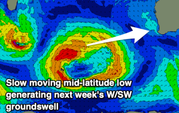
Slight upgrade in next week's fun SW swell.
Slight upgrade in next week's fun SW swell.
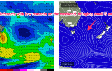
A new high pressure system moves E of Tasmania next week and there is some suggestion we’ll see a SE surge up the coast Tues, with a developing trade-wind flow through the rest of next week. Models are still divergent about the strength of the tradewinds so we’ll keep our jets cooled at far as size goes for now.
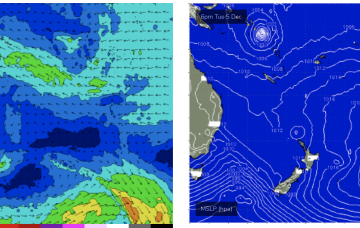
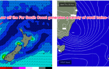
A dynamic weather event is underway as a complex inland low approaches the Far South Coast of NSW, expected to enter the Tasman Sea tomorrow. A moist NE-E/NE infeed into the low is generating plenty of rain (heaviest falls on the South Coast) and building swells from the same direction, focussed on NETas. We’ll see large surf develop across NETas as the low moves offshore tomorrow.
The coming days and weekend look poor for surf, with a fun window for early next week.
In the South Pacific the previously active area near the Solomons that has already spawned two tropical cyclones looks to flare up again next week with convective activity enhanced by a cross-equatorial flow. We may see a new tropical depression or even cyclone form later next week, with uncertain surf potential at this very early stage.
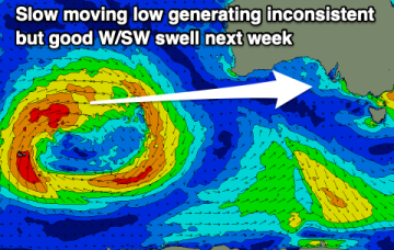
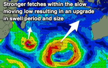
The low linked to the swell early next week has been upgraded in strength and we've got an upgrade in the expected size.
Poor winds will persist across the South Coast this period, improving early next week but with no swell. A fun new W/SW swell is due on the Mid Coast next week.
A dynamic weather event is underway as a complex inland low approaches the Far South Coast of NSW, expected to enter the Tasman Sea tomorrow. A moist NE-E/NE infeed into the low is generating plenty of rain (heaviest falls on the South Coast) and building swells from the same direction.
Onshore winds along with no quality swells of size are due this coming period.
Better swell due through next week.