Stacks of swell for Southern NSW, but looking best mid-late next week
Friday, 31 March 2017
Stacks of swell for Southern NSW, but looking best mid-late next week
Friday, 31 March 2017
The second half of next week looks unreal.
The second half of next week looks unreal.
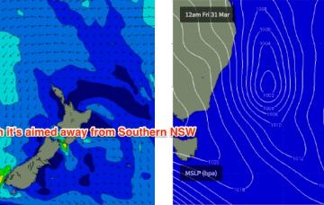
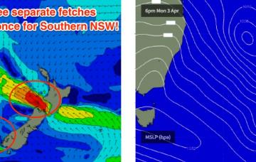
Unfortunately, the peak of this swell will coincide with a cold front crossing the region - attached to the same low that produced the swell (though it's now weakening).
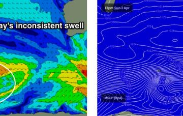
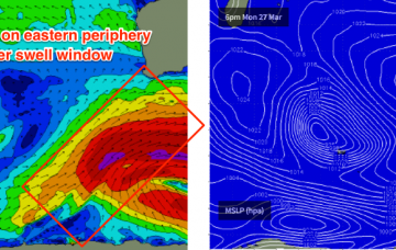
The models have been consistent all week, the satellite data confirms the model guidance and so we’re looking at very large waves building through Saturday, peaking late afternoon and easing slowly from Sunday morning.
This swell is expected to peak on Saturday though Friday’s late session could see similarly sized sets as the peak is expected to plateau for quite a decent length of time
The remains of TC Debbie are tracking southwards, and will merge with a northwards advancing southerly change that’s due to push across Northern NSW overnight Thursday and into Friday morning.
Saturday should be OK though it may be a little lumpy and leftover from Friday’s winds.
As alluded to in Monday’s notes, we have another large swell expected this weekend.
So, here comes the expected large swell for Thursday.
We’re at the bottom of the current swell cycle, with a new long period S/SW groundswell expected to build in the early hours of Wednesday morning.
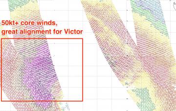
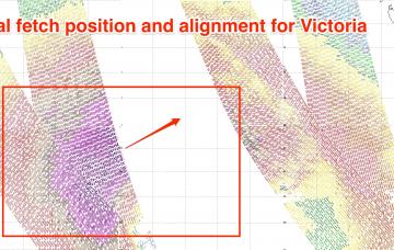
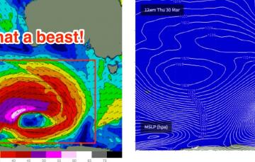
As it turned out, TC Debbie developed a little more slowly than initially thought, tracking very slowly to the mainland but at the same time, broadening the width of the fetch as it strengthened. Although right on the periphery of the swell window, this has resulted in a much bigger swell than initially expected.