Small windows of surf later week
Monday, 23 January 2023
Small windows of surf later week
Monday, 23 January 2023
Building surf from Wednesday afternoon with favourable winds each morning.
Building surf from Wednesday afternoon with favourable winds each morning.
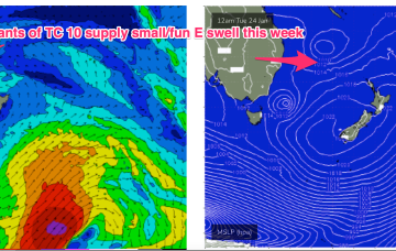
A troughy pattern exists through the Northern Tasman down to the South Coast with the remnants of TC 10P (named by JTWC but remained a cyclone for less than a day) drifting in a SW direction from out near New Caledonia as a weak sub-tropical low. A small low pressure cell near the South Coast is slowly drifting south leaving a variable flow in it’s wake across the f/cast region.
A troughy pattern exists through the Northern Tasman down to the South Coast with the remnants of TC 10P (named by JTWC but remained a cyclone for less than a day) drifting in a SW direction from out near New Caledonia. A small low pressure cell near the South Coast is slowly drifting south leaving a variable flow in it’s wake across the f/cast region.
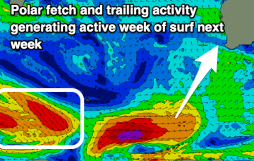
Strong cross-shore winds will spoil a coming swell while there's more opportunity for a surf next week with good pulses of swell and more favourable winds.
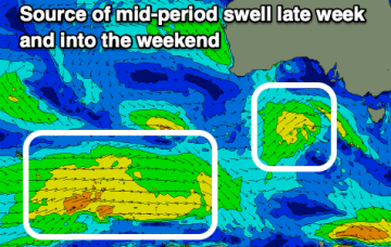
Windows of lighter winds and mixed swells this period owing to troughy weather.
Winds are looking better this week with troughy weather and generally favourable morning conditions.
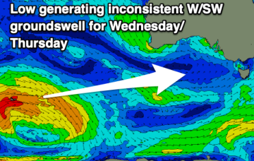
Great conditions with a good new swell tomorrow morning, easing ahead of some inconsistent, small W/SW swell energy next week.
There's not much to chase on the weekend, while some better swell is due next week but with poor winds.
Poor surf is set to continue across the South Coast for the period, with one small window next week.
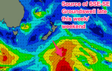
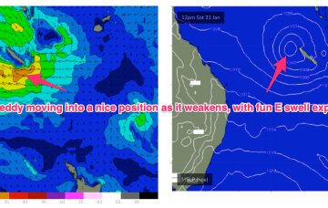
In the Coral Sea a depression on the end of the Monsoon Trough is organising with a high likelihood of forming a tropical cyclone (TC Freddy) - this is looking like a handy swell producer for the region although no real size is expected as the system weakens as the swell producing fetch moves into the swell window.