More swells from the S with some potential for next week to watch out for
Wednesday, 11 October 2023
More swells from the S with some potential for next week to watch out for
Wednesday, 11 October 2023
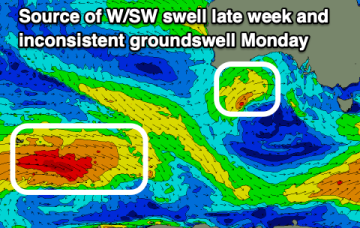
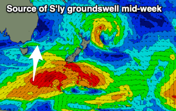
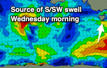
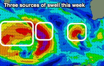
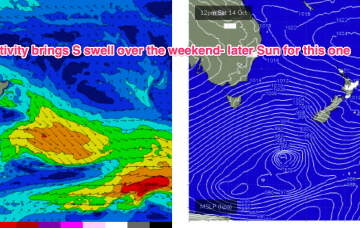
Moderate strength high pressure (1025 hPa) is drifting NE into the Tasman with a strong polar storm well SW of NZ exiting the swell window. That should see a settled short term before another complex trough and frontal system pushes north along the coast tomorrow with a stiff SW-S change. More rapid wind changes into and over the weekend under a very mobile, troughy pattern with some potential next week for a surface low to form in one of the trough lines.