Coupla south swells this week, mixed conditions

Sydney Hunter Illawarra Surf Forecast by Ben Matson (issued Mon 9th Oct)
Features of the Forecast (tl;dr)
- Easing S'ly swell Tues, though average conditions
- New S'ly swell Wed PM, early light winds and NE sea breezes (northern corners for the late session)
- Easing S'ly swell Thurs with strengthening N'ly winds, late NE windswell
- Building S'ly swell Fri with generally good winds
- Tricky weekend, likely easing S'ly swells Sat, rebuilding Sun
- Potentially solid S'ly swell early next week
Recap
Southerly swells maintained strong 3-5ft sets across south facing beaches both Saturday and Sunday, with southerlies affecting conditions at times on Saturday, but a more general offshore flow filling in for Sunday morning ahead of weak afternoon sea breezes. Wave heights eased into this morning though not as much as expected, thanks a new S’ly swell arriving a little sooner than forecast (AM rather than PM), and with a little more size (3-4ft south facing beaches). Early light offshore winds have given way to moderate NE sea breezes.
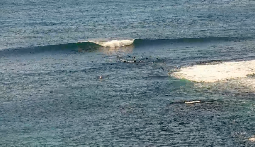
Nice waves in the Shire this morning before the sea breeze
This week (Oct 10 - 13)
The early arrival of today’s south swell means the short term schedule has been brought forward, essentially an easing trend through Tuesday and early Wednesday. South facing beaches may pick up stray 2-3ft sets early Tuesday but otherwise expect a gradual decrease in size. It’ll be smaller at beaches not open to the south.
Conditions look a little average on Tuesday with a weak trough sliding up the coast, bringing about a shallow S/S change early morning, tending SE through the day. We may see a brief period of light variable winds at dawn north from Sydney, otherwise expect ruffled condition under the moderate breeze.
Wednesday afternoon will herald the arrival of a small long period S’ly swell (earlier on the South Coast) from the final polar low flaring up in our south swell window off the ice shelf, this morning. Swell periods are expected to jump 14-15 seconds and south facing beaches should consequently see 3ft+ sets by the end of the day. Again, expect smaller surf elsewhere.
Wednesday’s conditions look clean through the morning but NE sea breezes will bump up everywhere but sheltered northern corners into the afternoon. Expect undersized surf size earely morning prior to the new swell arriving.
Wave heights will then gradually ease from the south through Thursday, as northerly winds freshen about the coast, introducing some local NE windswell into the afternoon that could push 2-3ft on dark.
A gusty S/SW change will then sweep across the coast overnight Thursday, and we’ll see building S’ly swells in its wake, partially sourced from the S/SW fetch adjacent the coast but also W/SW winds exiting eastern Bass Strait (the NE swell late Thursday will probably be gone by early morning).
Current expectations are for generally light offshore winds to prevail by Friday morning ahead of afternoon sea breezes, so conditions should be good, and an optimistic assesment on the current model runs suggests 3-4ft sets at south facing beaches by the afternoon (smaller earlier), with bigger waves possible across the Hunter. But we’ll tidy up that assessment in Wednesday’s update.
This weekend (Oct 14 - 15)
I’m not super confident on the weekend outlook.
Although we have a steady frontal supply pushing across Tasmanian longitudes from late Thursday onwards, the progression looks to break down temporarily Friday afternoon, before resuming sometime Saturday morning.
This is crucial for the weekend’s surf prospects, because Friday’s southerly swells will be easing through Saturday, and it appears that the swell window may not fire up until Saturday afternoon - in two regions (exiting eastern Bass Strait, and coming around the SE corner of Tasmania).
As such, Saturday looks to be - at this stage - in an easing phase, perhaps some 2-3ft sets at south facing beaches (bigger on the Hunter) but smaller by the afternoon.
Sunday should see a small bump in size from the fetch exiting eastern Bass Strait, but the fetch just off Tasmania’s SE coast will have another day’s travel time to reach Sydney so Monday may end up seeing the peak from this source.
Either way, both fetches will be off-axis to our swell window so size prospects are currently around the 2-3ft mark at south facing beaches.
Let’s take a closer look on Wednesday to see how the strength and timing of each pulse is looking.
Next week (Oct 16 onwards)
A more meridional LWT pattern is on the cards for early next week, which suggests a stronger, bigger round of south swell for Southern NSW - maybe even the formation of some kind of significant low pressure system in the Tasman Sea too. More on that in later updates this week.