Good swell for the weekend with decent winds
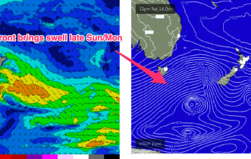
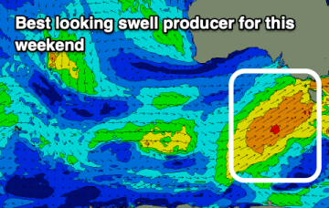
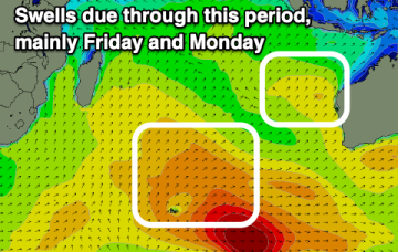
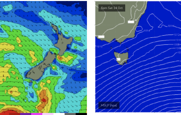
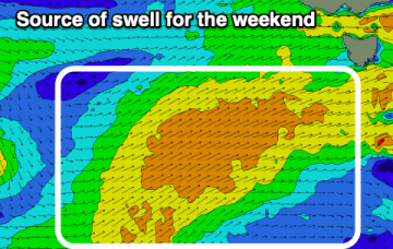
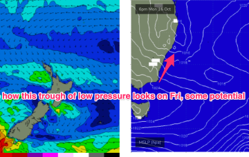
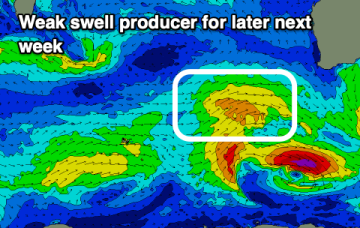
A good swell is due on the weekend with strong winds tomorrow, cleaner but easing Sunday. Next week looks mostly average.
We’ve got more clarity on the situation next week now as a lingering trough line from the NSW South Coast down to Gippsland is expected to deepen in response to a front and form a surface low in the Tasman Sea, likely later Mon.
The coming period remains flukey with average winds for the Mid and workable conditions on the South Coast.
Tomorrow will be weak and average, much better into Sunday. Early next week looks generally poor, fun on the beaches mid-week.
Make the most of the coming swells as the outlook looks slow.
Weak winds in the Coral Sea and approaching fronts have shut down swell productions for CQ. As a result we're looking at tiny/flat surf over the weekend with onshore winds. This continues into early next week.
Sunday looks a little juicier as the large fetch of gales passes into the Tasman generating a stronger S swell.
Easing surf is due tomorrow, increasing a little again Friday but more so on the weekend with plenty of wind.
Moderate strength high pressure (1025 hPa) is drifting NE into the Tasman with a strong polar storm well SW of NZ exiting the swell window. That should see a settled short term before another complex trough and frontal system pushes north along the coast tomorrow with a stiff SW-S change. N'ly winds into the weekend under a very mobile, troughy pattern with some potential next week for a surface low to form in one of the trough lines.
Better winds and fun swell pulses are due into the end of the week and weekend, deteriorating from Tuesday next week.