An imminent return of the northerly
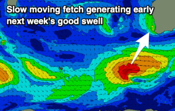
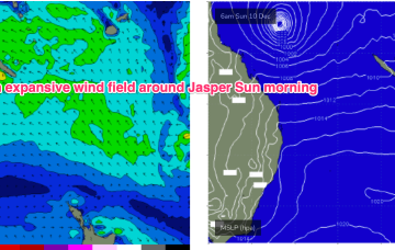
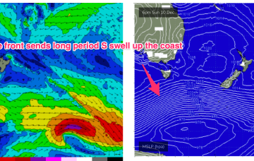
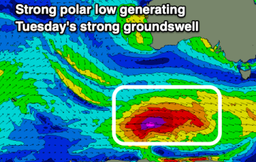
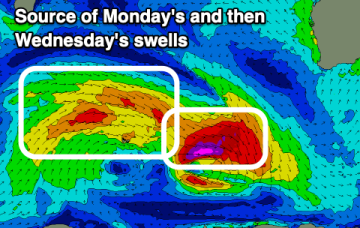
We're now at the peak of the swell cycle from STC Jasper so it's a slow dowards trend for the rest of the week.
The coming week will be generally small to tiny, with a better swell due early next week.
A run of offshore winds with some large, quality groundswell is expected over the coming days.
From about lunchtime onwards (South Coast) and late afternoon across the Sydney region, we'll be on high alert for the leading edge of a decent long period southerly groundswell.
Winds are dicey for tomorrow with a strong peak in SW groundswell, better as it eases from Wednesday.
Severe TC Jasper has been slow moving and intensifying (Category 4 now) over the last 36hrs. It’s slow (2-3kts) S/SW track between 158-156E is in the NE swell window. That aids confidence in some NE groundswell from STC Jasper over the weekend.
A powerful front and parent low passing under the continent and lower Tasman Sun into Mon looks to supply long period S’ly groundswell.
Strong onshore winds will move in tomorrow, with a weak windswell for Sunday. A large, strong groundswell is due next week.
A good but inconsistent swell is due later today and for the weekend with favourable morning winds.
It’s slow (2-3kts) S/SW track between 158-156E is in the acute N/NE swell window- even though that part of the window tends to be flukey due to interference from reefs and it’s reliance on a perfect track to clear Fraser and the Breaksea Spit. That aids confidence in some steeply angled N/NE-NE groundswell from STC Jasper over the weekend.