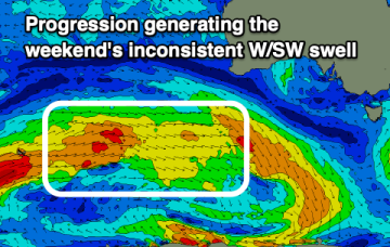
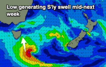
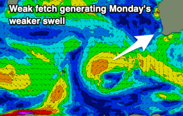
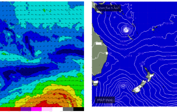
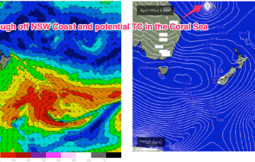
Lots of swell ahead with a a few days of onshore wind to get through
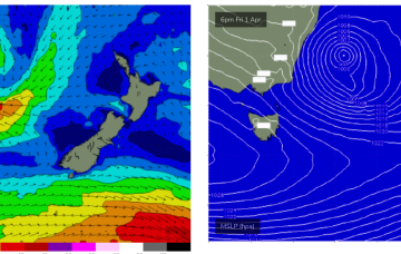
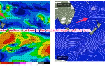
It's a classic "Summer" looking synoptic pattern and indicative of the La Nina pattern hanging on.
Small, weaker swells with favourable winds for the Mid Coast, less so for the Victor region.
Nothing to major swell wise and with deteriorating winds this week, funner on the weekend.
Nothing to recommend over the coming period besides possibly Wednesday. Try the East Coast notes.
No standout days with dicey winds when any swell arrives.
A deep Tasman low is expected to reach peak strength through this a’noon, with a general southwards movement favouring ETas, as it places the fetch wrapping into the SE quadrant within the swell window.
Into next week and things get a bit more juicy. A high pressure ridge and weak but long tradewind fetch extends out through the Coral Sea towards New Caledonia later this weekend and into Mon.
The trough off the NSW Coast is expected to deepen and in conjunction with the large high moving at Tasmanian latitudes, create a large SE to E’ly fetch aimed at NENSW and SEQLD.
That will offer a window of improving conditions at Big Wave Spots, albeit under strong offshore conditions, which will make any offshore bombies hard to ride.
It's hardly an autumn surf outlook in the early stages of the month unfortunately.