Strong S swell for Sunday with dicey winds
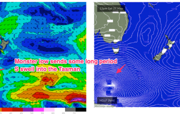
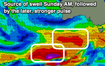
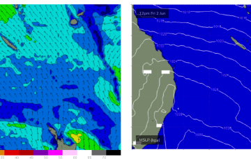
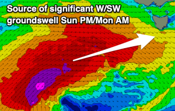
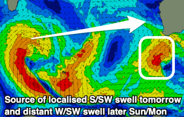
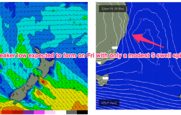
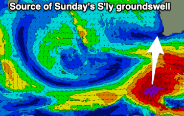
There's a good mix of S'ly and W/SW swell due on Sunday but winds won't be ideal for the South West. They should be workable for some spots though.
The expected Tasman low forming in the wake of todays front really falls apart, forming instead a raggedy low pressure trough which moves away quickly to the NE overnight and into Sat.
The South Coast will see the surf increase in size and period over the coming days under favourable winds.
We've got building surf with great winds for select locations and the experienced. Enjoy.
We’ve got a classic winter-style pattern happening at the moment with high riding high pressure, an active Southern Ocean storm track and pumping surf for Vicco, small surf wrapping into NSW and a flat spell for QLD. This winter pattern continues for most of next week but there is a little ray of hope on the horizon, ironically as we head into the first week of winter.
We've got a significant polar frontal progression on the cards this period with favourable winds as it builds, peaks and eases.
As we come to the end of Autumn we’ve got a typical looking winter synoptic pattern unfolding with a dominant high drifting over NSW bringing settled conditions with a very active Southern Ocean storm track spawning a strong cold front which will impact the state on Thurs. Most of the swell generating winds are better placed for Victoria with only small S swell wrap for NETas.
We've got cleaner conditions with a good sized S/SW swell tomorrow, easing into the weekend. A large S'ly groundswell will be met with tricky winds Sunday.
As we come to the end of another (very!) active Autumn we’ve got a typical looking winter synoptic pattern unfolding with a dominant high drifting over NSW bringing settled conditions with a very active Southern Ocean storm track spawning a strong cold front which will impact the state on Fri. The front and an upper low are expected to form a surface low Fri off the Central NSW Coast. Compared to Mon’s notes this low is now expected to be weaker and much faster moving bringing a smaller, faster up and down in S swell.
As we come to the end of another active Autumn we’ve got a typical looking winter synoptic pattern with a dominant high drifting over NSW bringing settled conditions with a very active Southern Ocean storm track spawning a strong cold front which will impact the state on Thurs. The front and an upper low are expected to form a surface low Fri off the Central NSW Coast. Compared to Mon’s notes this low is now expected to be weaker and much faster moving bringing a smaller, faster up and down in S swell.