Complex though extended run of E/NE swell, plus a few punchy south swells
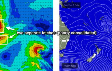
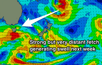
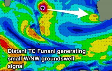
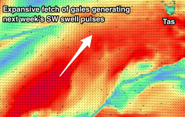
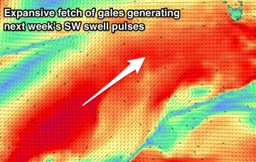
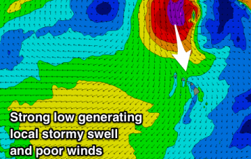
The South Pacific synoptics are very tricky.
Despite looking amazing on the synoptic chart, potential wave heights are likely to be considerably smaller compared to what we'd expect from a broad, consolidated, slow moving system of about the same size. More in the Forecaster Notes.
The South Pacific is really going to become quite active over the coming days.
Improving conditions with a good E/NE swell tomorrow, cleaner and fading Friday. New long-range E/NE groundswell for mid-next week.
No decent swell to finish off the week, with better W/SW swells increasing in size and power from the weekend.
Small to tiny swells with average winds when biggest. A bit more potential into next week with a couple of funky swell sources.
Poor winds and weak swells until Sunday when some better surf with more strength and favourable winds develop. Hold out until then.
Building swells in size and power from the weekend, best through early-mid next week.
Fun waves on the North Shore mid-week but then becoming poor and XL from Friday through the weekend with unseasonal winds and weather. Better waves across Micronesia and PNG.
The South Pacific synoptic charts look very juicy as a strong passage of intense tropical storms push southwards through the waters between Samoa and Fiji, enroute to New Zealand.