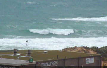
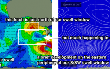
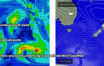
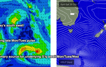
Smaller, less consistent swells from the west
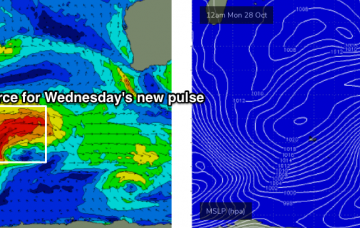
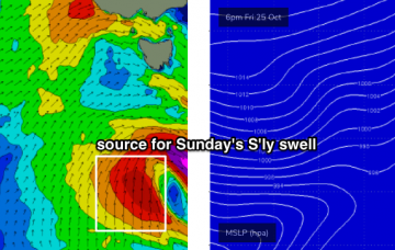
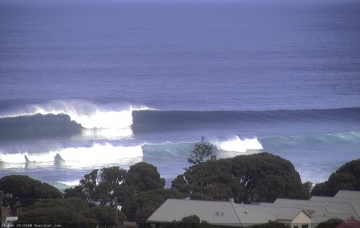
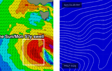
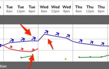
Fun windows of waves across the state with less consistent and small to moderate swells from the west.
The leading edge of an incredible long period swell is due to reach the WA coast early Saturday morning. More in the Forecaster Notes.
Although it’s unfortunate that the low has been downgraded in size potential, there is some good news: it’s expected to linger a little longer in our remote south swell window, and should generate some useful S’ly swell for a few days early next week. More in the Forecaster Notes.
So, we’ve got a lot of swell and wind lining up on the weekend charts and graphs. But, the surf outlook it’s not quite as straightforward as you might otherwise think. More in the Forecaster Notes.
Today’s combo of swells has originated from three sources: (1) long period groundswell (just registered 18 seconds at the CdC buoy), from a deep cut off low SW of WA on Tuesday, (2) mid-range swell from the associated front that tracked through the Bight Wed/Thurs, and (3) local windswell from local 20kt NW winds. More in the Forecaster Notes.
So, we’ve got a lot of swell and wind lining up on the weekend charts and graphs. But, the surf outlook it’s not quite as straightforward - or as good - as you might otherwise think. More in the Forecaster Notes.
There's a multitude of swells on the horizon, each of which looks pretty flukey though. More in the Forecaster Notes.
Sunday’s south swell will be related to a small fetch associated a much broader, more complex series of polar lows and fronts further south. More in the Forecaster Notes.
More large swells on the way, bigger than the last one! More in the Forecaster Notes.
Small residual S’ly swells will persist for the next few days though no major size is expected. There is some promise over the coming days though, from the north and south. More in the Forecaster Notes.