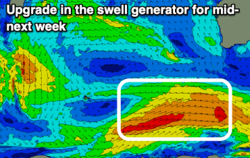
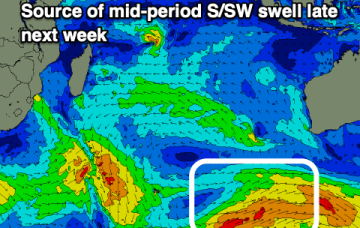
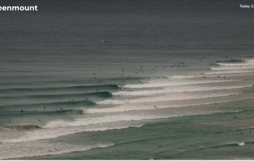
Large swell for tomorrow, cleaner and easing Sunday
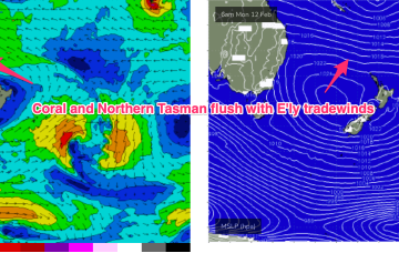
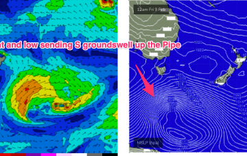
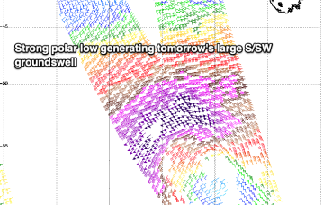
Another large swell is due for the weekend with varying options as winds swing around the compass.
The coming days will be poor for surfing with some better swell due mid-week.
The E’ly-SE’ly fetch gets reinforced later Sat by a new high pressure ridge squeezing up against a tropical low hovering NW of New Caledonia so we should see surf start to build again through Sun.
A trough off the NSW coast is focussing SE winds along the Eastern Seaboard, with a strong front/low traversing the Lower Tasman underneath Tasmania.
The coming weekend is active for surf but winds won't be as favourable as last week, best Sunday morning.
The E’ly-SE’ly fetch gets reinforced later Sat by a new high pressure ridge squeezing up against a tropical low hovering NW of New Caledonia so we should see surf start to build again through Sun, again, tidally affected by the big new moon tidal amplitudes.
We’ve got a very strong high pressure belt at the moment with a cell in the Tasman (twin cells actually, straddling New Zealand) and monster high moving in from the Bight. A trough off the NSW coast is focusing SE winds along the Eastern Seaboard, with a strong front/low traversing the Lower Tasman.
We've got another large, powerful S/SW groundswell due tomorrow but with average winds, improving Sunday.
Nothing of note in the Maldives with small swells in Indonesia.
The surf outlook for SE Qld and Northern NSW is relatively straightforward, all thanks to an anchored ridge across the Northern Tasman Sea.