Days and days of quality waves ahead (if you like the points)

South-east Queensland and Northern NSW Surf Forecast by Ben Matson (issued Wed Feb 7th)
Features of the Forecast (tl;dr)
- Extended run of strong trade swell, becoming large later Sun, peaking Mon, easing very slowly Tues onwards
- Fresh SE winds the norm for the next week
- Plenty of other swell sources on the cards, but with these conditions the next two weeks will be best suited for the regional points
Recap
Plenty of trade swell for the last two days, with cool south-east winds favouring the regional points. Size has been pulsing between 2-3ft to 3-4ft at times.
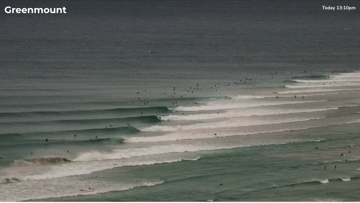
The Superbank in form this afternoon
This week (Feb 8-9)
As Steve mentioned on Monday, the synoptic are quite complex at the moment.
However, for all intents and purposes, the surf outlook for SE Qld and Northern NSW is relatively straightforward, all thanks to an anchored ridge across the Northern Tasman Sea. It’ll maintain fresh SE winds across most regions from today through until about Monday next week, which means irrespective of the size, source, direction and period of the swell, you’ll be working around the protected points and other sheltered locations for the best waves.
Let’s take a bit more of a closer look at the synoptic details.
The trade flow across the Northern Tasman Sea is currently broadening, and strengthening a little too, which means we’ll see surf size become more robust (but probably not a great deal bigger) into Thursday and Friday. This will probably translate into a more uniform coverage of 3-4ft waves, with bigger sets at the regional swell magnets - though these spots will be wind affected.
Semi-exposed points throughout most of SE Qld and Far Northern NSW should be quite fun, and they’ll be best on the lower tides.
An unrelated trough of low pressure in the southern Tasman Sea will drive gusty southerly winds across the Mid North Coast on Thursday, as well as generating a small level of secondary SE swell for the region. No major size is expected though and you’ll have to swing into the sheltered southern corners for anything worthwhile here.
Friday should see similar surf as per Thursday, but with a steady easing of winds throughout the Mid North Coast as the southern trough eases and contracts to the south. Winds will still be out of the south - perhaps an early SW breeze in some parts - but it won’t be as blowy as Thursday. Fresh SE winds will maintain across northern regions, favouring the points again.
Additionally, Northern NSW will pick up a secondary long period S/SE swell on Friday, generated by gales off the ice shelf on Monday. It probably won’t provide any more size than the pre-existing SE (and trade) swell, but should add occasional rogue sets into the mix as the swell trains combine.
This weekend (Feb 10-11)
Trade swell activity will peg back a touch throughout Saturday before building again on Sunday.
The main reason for Sunday’s size increase is related to a tropical low that’s currently forming in the Coral Sea, NW of New Caledonia. It’s moving to the south-west and may impact New Cal later Friday and into Saturday, but its direct swell potential will initially be limited for our region (i.e. for the next few days) due to the shadowing effects of the surrounding islands.
However, on Saturday the low will work in conjunction with an advancing southerly change linked with a powerful Southern Ocean low/front that’ll nose into the lower Tasman Sea overnight Friday, with a strong high pressure ridge trailing behind, muscling into the SE Qld / Nth NSW coast.
The squeeze between the tropical low - that could very well become a low end Cat 1 tropical cyclone - and the Tasman high pressure system will generate an expansive wind field of 25-35k E/SE winds across the northern half of the Tasman Sea, effectively a supercharged trade flow.
This will generate days and days of waves for all coasts over the following week, with the upward trend kicking in from Sunday, reaching 4-5ft by the afternoon across Far Northern NSW and SE Qld, under gusty SE winds. We may see some bigger waves approaching the 6ft+ range towards dusk.
Expect slightly smaller surf south from Yamba, but with similar winds.
Saturday should see slightly smaller, easing surf with early light winds in a few locations becoming fresh throughout the day as the ridge starts to take shape.
Also worth pointing out that Sunday afternoon will see the arrival of along period southerly swell, generated by the parent Southern Ocean low to the weekend’s coastal southerly wind surge. Unfortunately local winds will render most locations open to the swell quite bumpy, but as a guide, south facing beaches south from about Coffs could pick up 6ft sets from this source (even more size is likely in Southern NSW).
Next week (Feb12 onwards)
The super-charged trade flow is likely to result in conditions we sometimes refer to as a ‘fully developed sea state’, which means we’ll probably see maximum wave heights for the corresponding wind field.
The resulting surf will peak on Monday with 6-8ft+ sets across exposed coasts (smaller across the points), then easing very slowly from Tuesday until Friday, when it’ll probably bottom out in the 4ft range to finish the working week.
Wave heights will probably be a little smaller across the Mid North Coast throughout this period, but it’ll still be quite large and only suitable for sheltered locations.
Keep in mind Sunday’s late southerly groundswell will also be in the water on Monday - mainly south facing beaches in Northern NSW, particularly south from Coffs - but it will gradually ease through the first few days of next week.
As for winds, an easing trend through Monday and Tuesday will become light and variable by Wednesday under the influence of a weak high pressure system, before another coastal ridge freshens SE winds about the coast from Thursday onwards.
Either way, we’ve got days and days of quality waves ahead. So, pace yourself accordingly!
See you Friday!
Comments
Great read on this one Ben, thanks.
Really fun 3ft barrels here yesterday arvo.
Mostly E'ly tradeswell with some smaller SE swell energy making it run nicely.
next two weeks are gonna be fun
Been some fun waves on the beachies early mornings, if you can get out of the wind. D'Bah looking alright this AM.