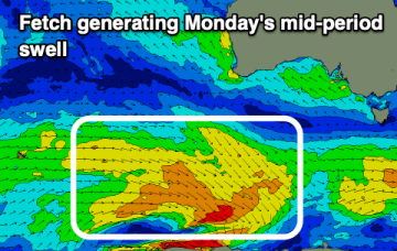
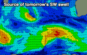
Fun swells this week but with windy conditions
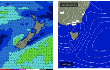
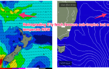
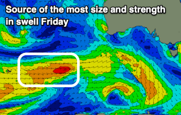
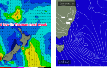
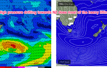
Winds will be less than ideal and with strength most of this week along with some fun swell.
The low east of Tasmania supplies plenty of strong S-SE swell through the short term with an easing trend back to small background swells this week.
Once the Tasmania low clears there picture we’ll see monsoonal activity develop through the South Pacific/Coral Sea, likely with a broad area of low pressure squeezing pressure gradients along a long fetch between the North Island and near Island chains and retrograding back towards the East coast through the second half of this week.
The coming days will be small ahead of some new W/SW swell later week with favourable winds.
Troughy weather and flukey winds will create tricky conditions for surfing. Late week looks best ahead of a stormy SE windswell.
East swells will favour the sub-tropics for size, but we’ll see swell trains from this source filter down into temperate NSW. Longer term is starting to look very active as well.
The magnets will offer clean, small waves each morning on the weekend, while a deepening trough will bring strong onshore winds with a new swell Monday/Tuesday.
Not a great deal of change to the weekend f/cast other than the current SE surge lifting wave heights a notch into Sun as winds freshen through the Wide Bay/CQ region.
A much more significant increase in NE windswell is expected for Sun as the fetch ramps up down the NSW South Coast and into Bass Strait.
Surf-wise the fetch off the top of the high and a broad troughy area, holds another round of E’ly quadrant swell in the 2-3ft range, very similar to the last round. Quality will be wind affected but we should see light enough winds in the morning for glassy lightly wind affected surf.