Rideable waves likely to return next week
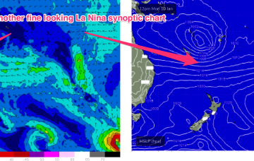
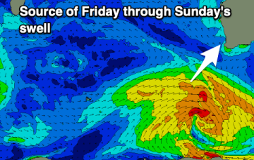
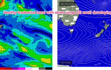
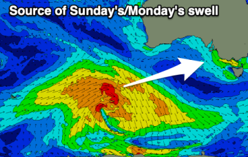
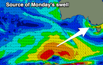
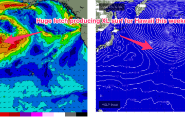
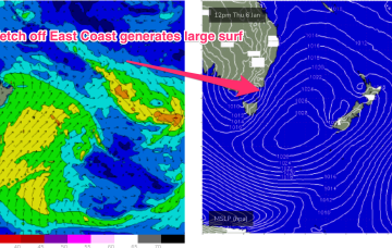
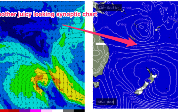
Next week looks to have better prospects although we won’t have the surf potential we saw from TC Seth.
The sub-tropical high pressure belt also extends Eastwards of New Zealand and the cradling effect of this belt along the low pressure zone is expected to create a long fetch of enhanced Tradewinds during next week.
There's no swell in sight for Perth and Mandurah and the Margaret River region is looking well below par.
A strong high is now slipping in underneath Tasmania and the combination of the decaying ex cyclone, developing high pressure ridge and an interior trough is creating a long, broad fetch E/NE winds extending from New Caledonia down into the Central Tasman Sea.
There's no quality surf due through this period with poor winds and blocking highs.
We'll see conditions improve slowly into the end of the week with a mix of sizey SE windswell and smaller, mid-period SW swell.
The drop in size is short-lived as an XL swell event builds in for the weekend 8/9 Jan. This swell will be generated by one of the powerful storms pushing off Japan as part of the huge cyclonic gyre covering the North Pacific.
A second, much stronger swell from the E/NE to NE quickly follows as a dominant high slips under the state and quickly has a pressure gradient squeeze from an inland trough and the remnants of ex TC Seth.
A long cradling fetch of E/SE Tradewinds forms in that general region, which is likely to be a more reliable swell producer, especially for the more exposed breaks on the Burnett coast.
More action in the tropics next week. Later this week another tropical low is expected to form in the South Pacific- possibly between Fiji and Vanuatu.