Tricky winds with a couple of swells
Friday, 7 January 2022
Tricky winds with a couple of swells
Friday, 7 January 2022
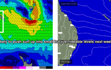
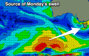
The weekend will mostly consist of windswell until Sunday afternoon, with a better swell for Monday.
The weekend will mostly consist of windswell until Sunday afternoon, with a better swell for Monday.
This sets up a good coverage of tradewinds through the Southern and Central Coral Sea, extending out to New Caledonia, where a tropical low located between Fiji and Vanuatu is located.
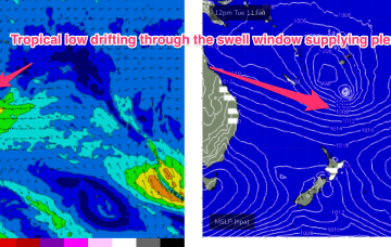
By Tues the wave climate will come more under the direct influence of the tropics, with a broad Tradewinds band being accelerated by a tropical low drifting South from area between Fiji and Vanuatu.
Average conditions and small swells continue with limited surfing options.
By Thurs the wave climate will come under the influence once more of the tropics, with a broad Tradewinds band being accelerated by a tropical low drifting South from area between Fiji and Vanuatu.
There are more options for a peaky wave down South over the coming period with an improvement in the local wind forecast. The swell is a bit hit and miss though.
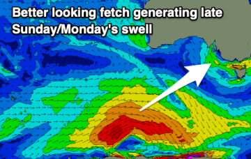
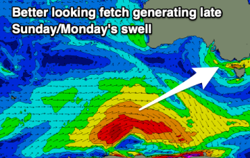
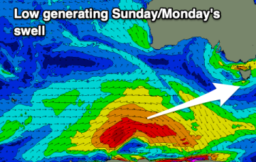
There's some OK swell due through Sunday/Monday and we've got a better wind forecast on the cards before things deteriorate into next week.
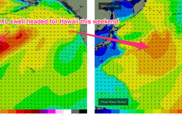
A monster storm consisting of twin lows pushing off Japan and the Kuril Islands with severe gales to storm forces winds over a huge area pushes seas in excess of 30ft to within 1000nm of Hawaii.
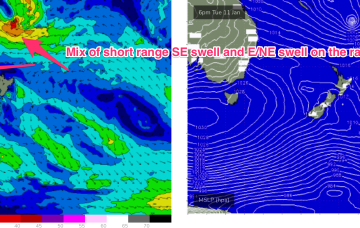
Winds won't play ball for the coming swells, spoiling conditions as they peak.
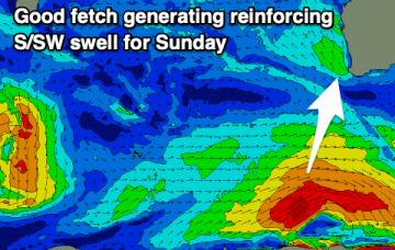
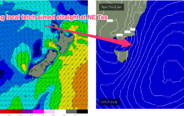
This fetch gets super-charged off Bass Strait and adjacent to the east coast of Tasmania by an interior trough, with E to E/NE gales expected to develop off the Gippsland coast later tomorrow (see below).