Tiny swells with tricky winds
Monday, 3 January 2022
Tiny swells with tricky winds
Monday, 3 January 2022
Not the best outlook with mostly tiny surf and tricky winds from the eastern quadrant.
Not the best outlook with mostly tiny surf and tricky winds from the eastern quadrant.
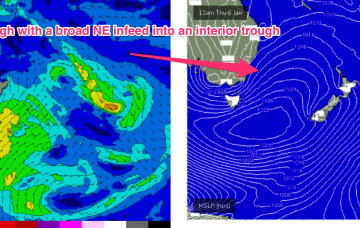
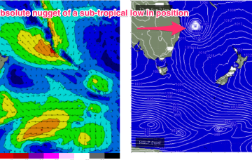
Swell from ex TC Seth, which transitioned into a gale force sub-tropical low Sun is the major synoptic feature this week, responsible for both swell production and directing gradient winds as it slowly weakens and meanders close to the NENSW/SEQLD coast for the next few days.
Small swells and not favourable for Perth and Mandurah. There should be a couple of fun mornings in the South West this week.
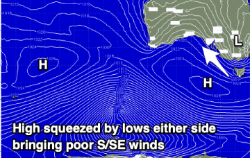
The coming outlook remains poor with persistent winds out of the south and no major swell for the Mid Coast, just tiny teasing swells.
An average couple of days ahead before conditions improve from Thursday along with a fun mix of easing swells.
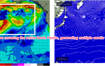
Stronger surf fills in next week as a more winter-calibre storm pattern begins to set in, with storms off Japan following a favourable jet stream pattern.
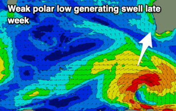
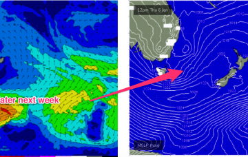
An intense sub-tropical low is expected to reach storm force Sun, spraying the entire East Coast with E/NE groundswell. Tasmania won’t miss out.
Not much to work with but there are a couple of small swells on the cards.
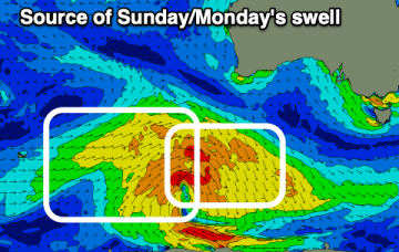
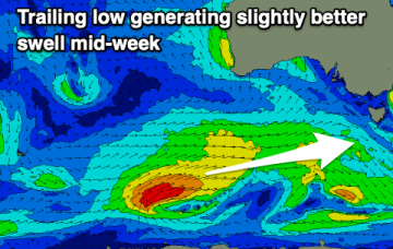
A tropical hybrid low is now tracking SE down the Coral Sea, roughly parallel to the QLD coast. This will bring plenty of solid swell to the f/cast region over the short term
The main issue is the incoming swells but Sunday is now looking a bit better wind wise.