Mixed week of surf, large and stormy for the weekend again

South Australian Surf Forecast by Craig Brokensha (issued Monday July 19th)
Best Days: South Coast Wednesday, Thursday, Friday, protected spots Saturday and Monday, Mid Coast for the keen on Wednesday and stormy haunts Sunday
Features of the Forecast (tl;dr)
- New mix of S/SW swells tomorrow but with strong W/NW winds, shifting strong S/SW mid-morning
- Sizey, mid-period S/SW swell easing through Wed with variable winds (W/NW down South)
- Smaller Thu with fresh N/NE tending stronger NE winds
- Inconsistent, mid-period SW swell for Fri with N/NE tending W/SW winds
- Stormy NW windswell building Sat on the Mid with strong NW winds, larger Sun with strong W/SW winds
Recap
Stormy 3-4ft surf on the Mid Coast Saturday morning after kicking in size Friday afternoon, with abating swell and winds through the afternoon. Our variable winds for yesterday morning came to fruition with fun, lumpy 2-3ft waves on the Mid Coast.
The South Coast was sizey and bumpy Saturday, best in protected spots while conditions improved slowly through yesterday as the swell dropped from 3-4ft under persistent W/NW winds.
Today the South Coast is even cleaner with the swell dropping to an inconsistent 3ft across Middleton, bumpy and to 1-2ft on the Mid.
This week and weekend (Jul 20 - 25)
We've got another wild and wooly forecast period ahead with strong mid-latitude lows and frontal systems due to move through from tomorrow.
Tomorrow isn't worth the drive from Adelaide as we'll see a strong S/SW change kick in by mid-morning, writing off the surf for the rest of the day. Strong, dawn W/NW breezes are due ahead of this change along with a mix of new S/SW swells generated by a polar low the last couple of days.
Size wise, Middleton should see 3-4ft sets in the morning, but the change itself will kick up a solid, mid-period S/SW swell through the day reaching 3-5ft across the Middleton stretch.
The Mid looks to kick to a choppy 2ft, but with no quality.
Tomorrow's front should clear to the west on Wednesday and winds look to ease off and tend locally offshore through the morning on the Mid, variable W/NW down South. There'll likely be lots of lump left in the swell down South from the overnight onshore winds, and we'll see easing S/SW energy from the 4ft+ range across Middleton.
The Mid looks on the tiny side and to 1-1.5ft but clean.
Winds look to pick up again into Thursday as a mid-latitude low pushes in from the west, bringing fresh to strong N/NE tending NE breezes with a further drop in swell back to 2-3ft across Middleton. The low is due to weaken while moving across us Friday bringing variable N/NE winds, ahead of a weak afternoon W/SW change. We'll also see a new, inconsistent mid-period SW swell in the mix, generated by a bunch of unconsolidated frontal activity through our swell window, south-west and south of Western Australia. Middleton should see inconsistent 3ft sets while the Mid comes in around 1ft.
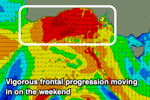 Of greater significance is a vigorous mid-latitude frontal progression pushing in from the west on the weekend with it being stronger than the system we saw moving through Friday and Saturday. We're set to see severe-gales projected under Western Australia and through the Bight Friday and Saturday with strengthening NW winds ahead of the front Saturday becoming gale-force into the evening and then shifting W/SW into Sunday.
We'll see a stormy NW windswell developing on the Mid Saturday, reaching 2-3ft, ahead of a larger, stormy W/SW swell Sunday to 4-5ft.
The South Coast will be very windy and tricky Saturday with 2-3ft surf across Middleton, while Sunday is expected to see choppy 4-6ft surf but with a strong W/SW breeze. It looks like Monday will be the pick down South as the swell swings SW, remaining large though easing along with strong NW winds, but we'll review this in the coming updates.