Plenty of bumpy swell for the Mid Coast

South Australian Forecast by Craig Brokensha (issued Friday 21st July)
Best Days:
Recap
Improving but easing surf from the 3ft range at Middleton on the South Coast as dawn onshores tended light NW ahead of weak sea breezes. The Mid Coast was clean but fading from a tiny 0.5-1ft.
Later in the day a new S'ly swell built down South and this has continued to offer fun sized waves into this morning with a light offshore wind. The Mid Coast became even smaller with a tiny weak north windswell.
This weekend and next week (Jul 22 – 28)
This morning's S'ly swell will drop back steadily through this afternoon and further tomorrow morning leaving small to tiny leftovers tomorrow morning down South. Middleton will be tiny, while Waits and Parsons may offer the odd set. Fresh N/NW winds will keep conditions clean but windy at times.
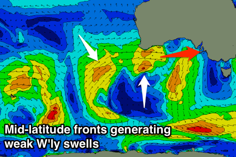
The Mid Coast should see some acute W'ly swell into the afternoon, generated yesterday afternoon and last night by a weak fetch of W/SW winds passing under WA.
 Sets to 2ft are due but those fresh N/NW winds will create average conditions, while the South Coast may pulse slightly to 1-2ft into the late afternoon at Middleton.
Our models are showing some long-period energy building into the afternoon, but there's no size to this and they're incorrectly combining the large periods with the weak westerly swell, over-forecasting the size.
A secondary mid-latitude front pushing towards and under WA today and then further through the Bight tomorrow while weakening should generate a slightly bigger increase in W/SW swell for the Mid Coast Sunday.
We're likely to see the Mid increasing from 2ft through the morning to 2-3ft into the afternoon, while again the size is being over-forecast down South. Only small 1-2ft sets are due across Middleton, possibly increasing to 2ft+.
Gusty W/NW winds will create poor conditions all day on the Mid Coast while favouring Middleton down South.
A slow drop in W/SW swell is due Monday from 2ft+ on the Mid Coast, holding around 2ft on the South Coast with a new S/SW swell, discussed below. The Mid Coast may see a period of light to moderate N'ly winds at dawn, but NW into mid-morning.
A weirdly aligned fetch of strong polar S/SW winds should produce Monday afternoon's small S/SW swell, keeping most breaks up around 2ft into the afternoon.
Into Tuesday a slightly stronger S/SW groundswell is expected down South, generated by a strong polar front firing up late in our swell window, south-west of Tassie. A fetch of W/SW gales should produce 2ft to possibly 3ft sets across Middleton through the day, but fail to impact the Mid Coast.
Instead a weak trough moving through the Bight Monday is likely to keep 1-2ft waves hitting the Mid, but with fresh W'ly winds.
Longer term we'll continue to see strong mid-latitude storms firing up towards WA and then weakening while approaching us mid-late next week, keeping W/SW energy hitting the state but with NW-W winds. More on this Monday, have a great weekend!