Good swells for Sunday and Tuesday with offshore winds

South Australian Forecast by Craig Brokensha (issued Friday 7th July)
Best Days: South Coast every day over the coming period, average and onshore on the Mid Coast until Monday when the swell becomes tiny
Recap
A good new long-period SW groundswell built through Wednesday afternoon, with 3ft sets off Middleton, but a peak expected Thursday morning wasn't seen with smaller surf across the region. Conditions were great all day and fun further down the beach and at Waits and Parsons.
The Mid Coast was tiny with a slight lift in swell through the afternoon, while today a mix of building W/SW groundswell and semi-stormy W/NW windswell is developing across the coast.
The South Coast is small and clean with good options at Waits and Parsons.
This weekend (Jul 8 - 9)
 Currently a mid-latitude low is moving in and across us, with a fetch of strong W/SW winds being projected through our western swell window. This will kick up 3ft of stormy swell on the Mid Coast by dark today, easing back through tomorrow as the low continues east.
We should see the Mid Coast easing from 2ft+ with a freshening NW tending W/NW breeze and a small trough moves in from the west.
The South Coast is expected to see a mix of weak W/SW windswell and long-range groundswell tomorrow morning, coming in at 2-3ft along the Middleton stretch, while the SW groundswell for Sunday looks to arrive a little earlier now and build into Saturday afternoon.
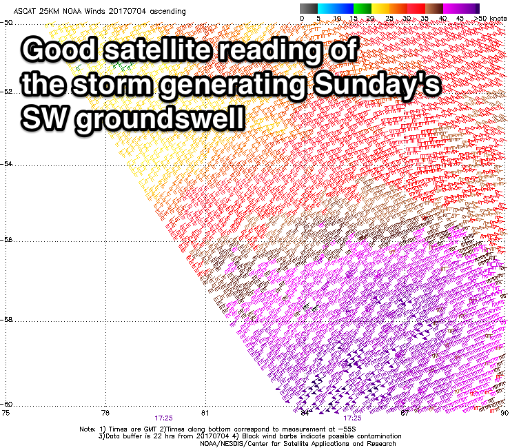
This swell was generated by a strong polar front in the Heard Island region earlier this week, with an initial pre-frontal fetch of NW gales setting up a small active sea state for a burst of stronger gale to severe-gale W/SW winds to move over. There were even a couple of 50kt barbs registered as shown in the picture right.
This system has since weakened but a good inconsistent and long-period SW groundswell is now heading towards us, with it due to arrive Saturday afternoon, building to 3ft+ by dark across Middleton ahead of a peak Sunday morning to 4ft.
Conditions look good most of the day with a NW-W/NW breeze, favouring Middleton and other breaks around town.
The Mid Coast should hang around 1-2ft with light to moderate onshore winds.
Next week onwards (Jul 10 onwards)
 Sunday's swell should ease off later in the day Sunday and further into Monday morning and conditions will remain favourable down South with a light to moderate N/NW tending NW breeze. The Mid Coast is likely to see an early NE'ly but with tiny waves to 1ft+.
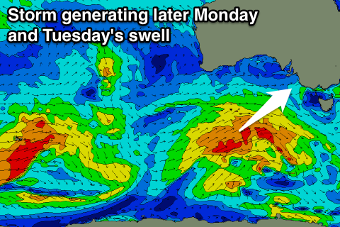
A good new SW swell is due later in the day, peaking Tuesday, generated by a broad but not overly strong polar front projecting up towards Victoria over the weekend, from the south-west of WA.
We should see Middleton coming in at 3-4ft on Tuesday morning, while the Mid Coast looks to remain tiny and around 1ft+.
Conditions will be excellent as a ridge of high pressure moves in from the west, resulting in offshore tending variable winds Tuesday, fresher from the N/NE Wednesday.
Longer term, a flurry of strong polar frontal activity south-west of WA should generate some new inconsistent W/SW groundswell for later in the week/next weekend, but more on this Monday. Have a great weekend