Brief windows across the Mid and South Coasts

South Australian Surf Forecast by Ben Matson (issued Friday 2nd January)
Best Days: Sat: South Coast very early ahead of a shallow SW change. Winds may briefly trend offshore late morning ahead of another shallow SW change early afternoon, in fact there could be a few small windows all day. Sun: late small clean lines on the Mid Coast. Mon: smaller and less consistent on the Mid. Wed: solid new swell with good winds for Victor.
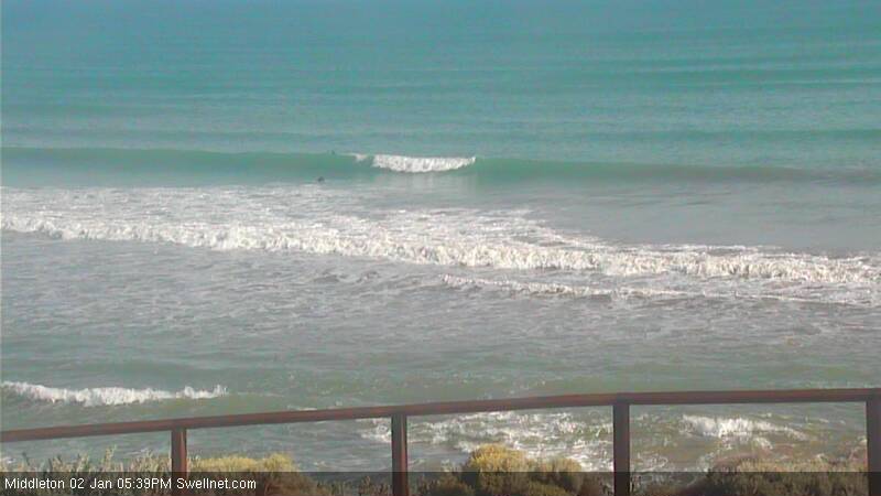
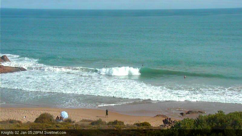
Recap: A brief window of light NE winds Thursday morning at Victor Harbor gave way to fresh to strong S/SE tending E/SE winds during the morning, but interestingly winds veered back to the N/NE around lunchtime and remained there until about 4pm before swinging onshore again. As such there were a few more windows of opportunity that was expected. The Mid Coast was clean but surf size was tiny. Today we’ve seen tiny conditions persist on the Mid but fresh offshore winds (and extreme heat!) along with a clean groundswell in the 2ft range at Middleton with 3ft sets at Waits and Goolwa (see a couple of snaps from the Middleton and Knights surfcams below).
This weekend (Jan 3-4)
Onshore winds will generally ruin conditions at Victor Harbor this weekend. However if you wanted to gamble, there’s a reasonable chance that - much like Thursday - there may be a few windows of opportunity open up on Saturday.
The reason for this is that we’ve actually got several ‘changes’ on the way. Sunday can be safely written off, thanks to a high pressure system ridging in behind a weak front passing south of the state, driving gusty SE winds across the coast. However Saturday will see a complex, slow moving trough across the region and although winds are likely to veer south-west early morning (say around 6-7am) and again in the early afternoon (say 1pm), we could very well see winds trend offshore for a few hours between these onshore bursts.
Surf wise, there won’t be much on offer, probably a similar size as per today (inconsistent 2ft sets off the point at Middleton, up to 3ft at Waits and Goolwa). But with the Mid Coast expected to remain tiny it’s worth considering being patient throughout the day.
On Sunday, Victor isn’t even worth a passing glance but we’ve got a small new groundswell expected to light up the Mid Coast in the afternoon. It’ll probably be very small and inconsistent in the morning but through the afternoon we should see 1-2ft sets fill into the gulf, kept clean with fresh SE winds. Keep an eye on the South Port surfcam and be prepared to pounce as necessary.
Next week (Jan 5 onwards)
There’s still nothing major is on the radar for the first few days of the new week. Monday should see some lingering lines along the Mid Coast, generally around 1ft and very inconsistent, but with a chance for a few stray bigger 1-2ft sets through the afternoon if we're very lucky. Victor will continue to be hammered by SE winds, so don’t bother with a South Coast mission.
Winds will slowly ease through Tuesday with no new signs of new groundswell, but Wednesday has some good potential.
A series of strong Southern Ocean fronts will migrate eastward through the waters well SW of West Oz over the weekend, and they’re expected to generate a strong groundswell overnight Tuesday, providing strong surf for Wednesday. Middleton should pick up inconsistent 3ft+ sets from this source, with bigger 3-5ft waves at Waits and Goolwa, and winds are expected to trend light NE as the high moves further east and a broad trough develops across most of the region (generally west of Adelaide to begin with).
This swell should persist through Thursday (although will ease slowly during the day) however we’re at risk of a gusty return southerly flow developing sometime around Thursday or Friday. So let’s wait and see how next week’s model data pans out.