Indonesia/Maldives forecast January 2

Indian Ocean Basin analysis by Craig Brokensha (issued Tuesday 2nd January)
This week through next (Jan 3 - 12)
A small, inconsistent groundswell seen through Sunday afternoon and yesterday is now easing across the region with smaller surf due tomorrow and Thursday.
Besides a small background swell into Thursday afternoon and Friday, the outlook remains slow until the weekend.
Our inconsistent SW groundswell for Saturday/Sunday is on track with it generate by a distant but good fetch of W’ly gales to the south-east of South Africa late last week.
It’ll be inconsistent and moderate in size, building Saturday and peaking overnight before easing slowly Sunday. Late Saturday and Sunday morning should reveal the most size.
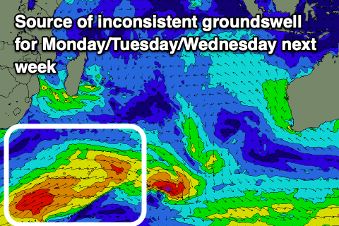
Following this, a secondary slightly bigger and more consistent SW swell is due, generated by an elongated fetch of strong to to gale-force W/SW winds that are currently drawn out to the south-east of South Africa. This progression will weaken while moving north of the Heard Island region, with the swell due to arrive Monday, peaking Tuesday, easing slowly Wednesday and Thursday as more distant energy from the earlier stages of the frontal progression moves in.
After this, smaller surf is due into the end of the week.
Winds over the coming period look variable, tending more W/SW-SW into the afternoons from mid-late next week.
Looking further west towards the Maldives and the E/NE windswell looks to persist most of the week thanks to monsoon E/NE winds from southern Indian and Sri Lanka.
Moderate + levels of S’ly swell are due over the coming days, ahead of some stronger S’ly groundswell later in the week, generated by the W’ly gales to the south-east of South Africa last week.
The swell is due to build Thursday, peaking Friday and then easing into the weekend.
Another good pulse of S’ly groundswell is then due early next week from the early stages of the secondary frontal activity to the south of South Africa. This again looks moderate + in size. These swells look stronger than any background SE trade-swell and winds look to go more variable across the region this week, providing plenty of options.
Eastern Indonesia:
Small, easing surf over the coming days with variable winds.
Moderate sized, inconsistent SW groundswell building Saturday (6th), reaching 4-5ft+ later on the magnets, easing slowly from a similar size Sunday (7th).
Reinforcing, inconsistent SW groundswell for Monday afternoon and Tuesday to an inconsistent 4-6ft on the magnets.
Variable winds continuing, tending W/SW-SW into the afternoons mid-late next week.
Uluwatu 16-day Forecast Graph/WAMs
Western Indonesia/Mentawais/South Sumatra:
Small surf over the coming days.
Moderate sized, inconsistent SW groundswell building Saturday (6th), reaching 4-5ft+ during the afternoon, easing slowly from a similar size Sunday (7th).
Reinforcing, inconsistent SW groundswell for Monday afternoon and Tuesday morning to an inconsistent 4-6ft on the magnets.
Variable winds this period, tending W/NW-NW at times.
Mentawai 16-day Forecast Graph/WAMs
Maldives:
E/NE windswell to 2-3ft across northern and central locations this week, easing into the weekend.
Background levels of mid-period S’ly swell to 3-4ft across the southern atolls.
Moderate + sized S’ly groundswell building Thursday, peaking Friday morning to 5-6ft across the southern atolls.
Easing surf into the weekend ahead of a secondary pulse of S’ly groundswell for Monday (8th) to 4-6ft on the southern atolls.
Winds tending variable through tomorrow, with a moderate to fresh E/SE breeze across northern/central locations Thursday, variable again Friday and into the weekend. W/NW winds across southern locations Sunday, more variable Monday with E winds to the north, strengthening through the week.
Comments
Latest notes are live.
Are these forecasts going to continue right through summer?
Yep.
Sweet. Thanks Craig
G'day Craig - what's the long range forecast looking like for the IOD - looking at the BOMs last update (19 Dec) the forecast mean looks to be borderline Positive IOD as of May - could we be looking at a stronger positive IOD this year?
Either way - looking forward to your next article on all things El Nino, IOD and SAM.
Thanks Craig, love ya work . The glorious weather continues.