Fun surf early next week, large long-period groundswell late week

Hawaii North Shore, Micronesia and PNG forecast by Craig Brokensha (issued on Thursday 15th February)
Best Days: North Shore - Monday through Tuesday and then Thursday and Friday, Micronesia - Thursday and Friday next week, PNG - Most days this period
This week and next (Feb 16 - 23)
Hawaii: A fun reinforcing NW groundswell has kept the surf up around 6ft on the sets through today with varying winds which have gone back offshore this evening.
This swell will drop right back overnight, leaving fading surf from the 4ft rang tomorrow with less than ideal W/SW winds, smaller Friday morning.
Some small background energy is due into Friday afternoon, holding through Saturday and Sunday with pulsing sets in the 4ft range at magnets with favourable winds Friday and Saturday morning, with less favourable N/NE breezes into Sunday.
 Our new pulse of NW groundswell for Monday afternoon and Tuesday morning is still on track, generated by an intense but short-lived and distant low spawning off Japan.
A fast moving fetch of gale to severe-gale W/NW winds will be projected in our swell window, with a moderate sized long-period NW groundswell due to arrive through Monday, building to 4-6ft into the afternoon/evening and then easing from the 5ft range Tuesday morning.
Winds look generally variable on Monday with similar breezes Tuesday, with small surf Wednesday under very light E'ly trades.
Looking at the secondary larger pulse of swell due Thursday/Friday and we've had an upgrade in size.
A strong low spawning off Japan will aim back to back fetches of severe-gale to storm-force W/NW winds through our swell window as it stalls, resulting in quicker than normal swell growth.
This will produce a large long-period NW groundswell for Thursday that's expected to build to a slightly inconsistent 8-10ft across the North Shore if not possibly for the odd bigger cleanup at its peak. Conditions look great with E/SE trades, with easing surf from 6-8ft Friday.
North Shore Forecast Graph
North Shore WAMs
 Micronesia: Easing trade-swell is expected over the coming days, surfable in spots out of the trade-winds tomorrow, too small from Friday.
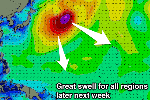
With the upgrade in the swell across the North Shore, we've also had an upgrade in the swell due later next week across our region, with the low stalling perfectly in our swell window while generating severe-gale to storm-force W/NW winds.
We should see a late kick in size Wednesday, with a peak Thursday to 6ft to occasionally 8ft, easing slowly through the day and further Friday.
Winds look great with fresh and gusty E/NE trades, with nothing too major to follow.
Palikir Pass Forecast Graph
Palikir Pass WAMs
Papua New Guinea: Some good sized NE trade-swell should be building across the region, reaching 4-5ft and holding a similar size over the coming days. An easing trend is due from Sunday and winds look to persist from the W/NW through this period, moderate to fresh at times.
Into later next week we'll see the N/NW groundswell arriving, kicking later Thursday and peaking Friday to an inconsistent 3-5ft before starting to ease slowly over the weekend.