A few options should present themselves

Eastern Tasmania Surf Forecast by Craig Brokensha (issued Wednesday February 21)
Best Days: Protected spots tomorrow, Friday morning, Sunday morning south magnets
Features of the Forecast (tl;dr)
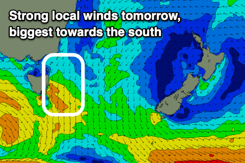
- Moderate sized N/NE windswell tomorrow with strong N/NE winds (lighter early)
- Easing N/NE windswelll Fri with gusty W/NW winds (sea breezes in some spots)
- Small building S swell Sat with fresh S/SW tending S/SE and then E/NE winds
- Easing S swell Sun with NW tending NE winds
Recap
Small surf yesterday while today, stronger N/NE winds are whipping up a north-east windswell that's now 3ft+ across the coast.

Building windswell this afternoon
This week and weekend (Feb 22 - 25)
Today's strengthening winds will increase further overnight and with this we can expect the north-east magnets to come in at 4ft tomorrow, lasting most of the day under what looks to be strengthening N/NE winds again through the day (light early).
Northern corners will be smaller but cleaner for the keen.
With the winds remaining strong most of tomorrow, the size should hold well into Friday morning with easing 3ft sets (2-3ft mostly) with fresh W/NW offshore winds, possibly giving into sea breezes in some locations and remaining offshore all day in others.
The NE swell will be all but gone on the weekend, but a S'ly swell from a strong low passing across the state on Friday looks a bit better.
The backside of the low is expected to generate a fetch of strong SW winds, with a fun pulse of mid-period S'ly swell due to build Saturday, peaking to 2-3ft on the south magnets into the afternoon.
Winds are unfortunately looking average and fresh from the S/SW, shifting S/SE and then E, not ideal. Sunday will be cleaner but with easing 2ft sets max across the south magnets.
Longer term the outlook is slow so make the most of the coming surf.