New buoy ahoy

Eastern Tasmania Surf Forecast by Craig Brokensha (issued Wednesday 31st March)
Best Days: Selected locations tomorrow, possibly early Friday, Saturday
Features of the Forecast (tl;dr)
- Flukey S swell for Wed with NW to NE winds
- Possible E/NE swell late next week
Recap
No reports of any S'ly swell yesterday, with that swell source now gone today.
This week and weekend (Apr 1 - 9)
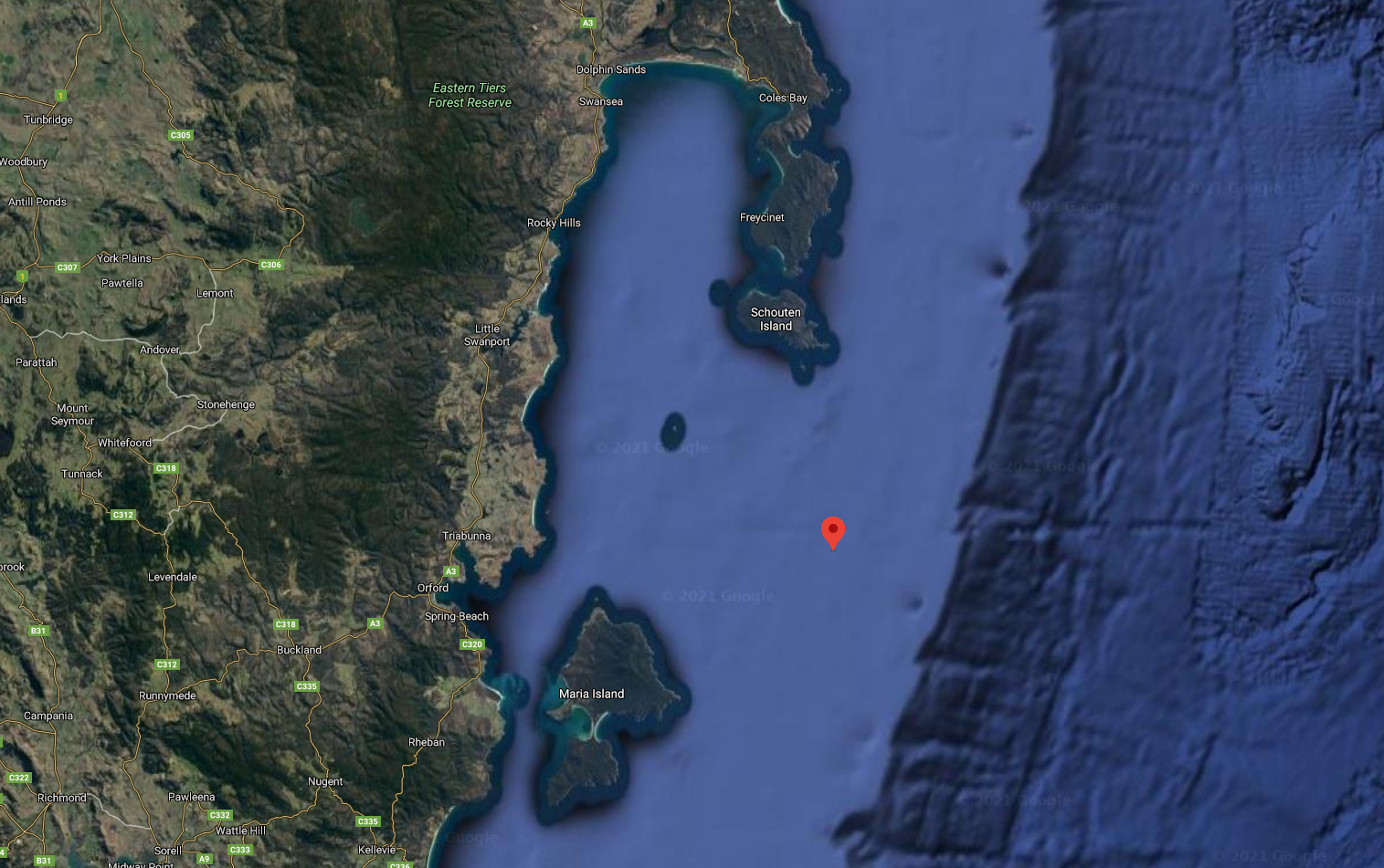
The main talking point of today's notes is a new wave buoy provided by the Bureau of Meteorology off out coast. It's located north-east of Maria Island and south of Schouten Island, open to swells from the south around to north-east.
It's a directional buoy as well so will pick up each different swell in the water if there si more than one present. For a run down on how to read the data, check this article out.
Coming back to the surf outlook across the state and unfortunately there's nothing of significance at all on the cards.
A strong frontal progression passing under us on the weekend will be too zonal to generate any swell of significance.
A slightly more polar fetch of W'ly gales could generate a small 2ft wave for south swell magnets Wednesday, but we'll keep a close eye on this.
Looking further afield and a tropical low forming in the Coral Sea will meander most of next week, out of our swell window, but it may drift south closer to us and into the Tasman Sea later next week, generating some fun E/NE swell next Friday/Saturday. Check back here on Friday for an update on this potential swell source.