Average this week, more action next week

Eastern Tasmania Surf Forecast by Craig Brokensha (issued Monday 8th April)
Best Days: Later Thursday and Friday morning south swell magnets, next week
Recap
Pumping waves Saturday with a strong N/NE swell and offshore winds offering waves across the whole East Coast. Come Sunday though there was nothing left, similar and tiny today.
Today’s Forecaster Notes are brought to you by Rip Curl
This week and next week (Apr 9 - 14)
As pointed out in Friday's forecast, last Saturday was the best day of the forecast period so I hope you made the most of it.
But if you didn't there are a couple of small S'ly swell pulses to get stuck into this week and greater surf potential into next week.
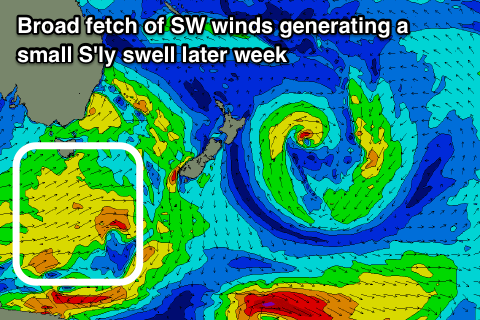 A strong frontal system that will push across us today will leave a trailing fetch of strong SW winds extending from the state down to the polar shelf.
A small refracted S'ly swell may spread into south magnets Thursday afternoon, easing Friday with small sets to 2ft or so, flat at all other locations.
Winds will be favourable for these south swell magnets with an afternoon NE sea breeze Thursday and strengthening N/NW'ly as the swell fades Friday.
There isn't expected to be any size left into the weekend, but into next week a strong high moving in between us and New Zealand's South Island will be squeezed on its western and northern flank by an approaching front and deepening tropical activity.
With this we should see a local N/NE windswell event building Monday/Tuesday and better NE trade-swell event spreading down into us later week into the Easter Long Weekend. This is a bit of a ways down the track so check back here on Wednesday for an update on this.