Tiny surf with marginally better prospects late week

Eastern Tasmania Surf Forecast by Guy Dixon (issued Monday 2nd May)
Best Days: No great days.
Recap:
A small northeasterly windswell peaked on Sunday with peaks in the 1-2ft range at open beaches, under persistent, fresh northwesterly winds. The small amount of energy has subsided today, ironed flat by more gusty west/northwesterly breezes.
This week (Tuesday 3rd - Friday 6th) and weekend (Saturday 7th - Sunday 8th):
The strongest nodes of the long wave trough will continue to remain to the east and west of our swell window, steering frontal more suited to South Australia and Victoria. Any southerly energy looks to be negligible in the coming week. Instead, we must rely on the our eastern swell window for surf.
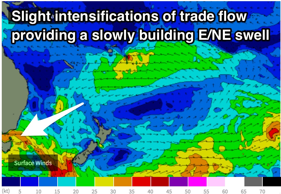
Tuesday, Wednesday and the better part of Thursday are likely to be undersized with no significant surfable size.
Later in the week however, we should see easterly trade energy slowly build as a result of an intensification in the trade flow.
A deepening trough over the northern Tasman/South Pacific looks interact with a strong ridge over NZ causing the pressure gradient to tighten and the main swell generating winds to tend more easterly as opposed to the east/southeasterly flow of the past few days.
The impacts of this fetch are not expected to be anything significant, but it should be bigger than what we are seeing. Friday should pick up sets in the 1-2ft range at open beaches, with a touch more size into the weekend.
Continued frontal activity on its southward track will maintain gusty conditions with fresh-strong westerly thru north/northwesterly breezes until the weekend. Conditions should be generally clean, but also ironed flat.
Despite weakening and becoming smaller in area, this fetch looks to drift closer to the NSW coastline while adopting a more northeasterly alignment.
 Trade energy should continue to build as a result, increasing to around 2ft across the weekend, predominately due to the modest captured movement of the main fetches.
A local north/northeasterly fetch looks to increase rapidly on Saturday night, but only pushing right into the coast for a brief period of time.
Short range windswell should build to around 4-5ft at northeast facing beaches by Sunday morning, with fetches along the NSW coast maintaining energy thereafter.
Breezes look to tend more northerly on Saturday, possibly even strong north/northeasterly on Sunday, severely impacting wave quality. Any size that’s seen at open beaches will be blown out and lacking shape.
More detail on Wednesday.