Stormy NE windswell to end the week

Eastern Tasmania Surf Forecast by Guy Dixon (issued Wednesday 27th January)
Best Days: Thursday morning and possibly Sunday morning.
Recap:
Tuesday morning offered well organised, but slightly inconsistent options in the 2-3ft range under a light southerly airflow. There were plenty of workable options, but winds gradually swung onshore and have remained that way ever since. Today's surf has been nothing but poor quality with a persistent easterly breeze making it's presence known.
This week (Thursday 28th - Friday 29th):
The local swell window looks to be the most dominant in the coming days, with a Tasman ridge already steering an easterly airflow over eastern Tasmania.
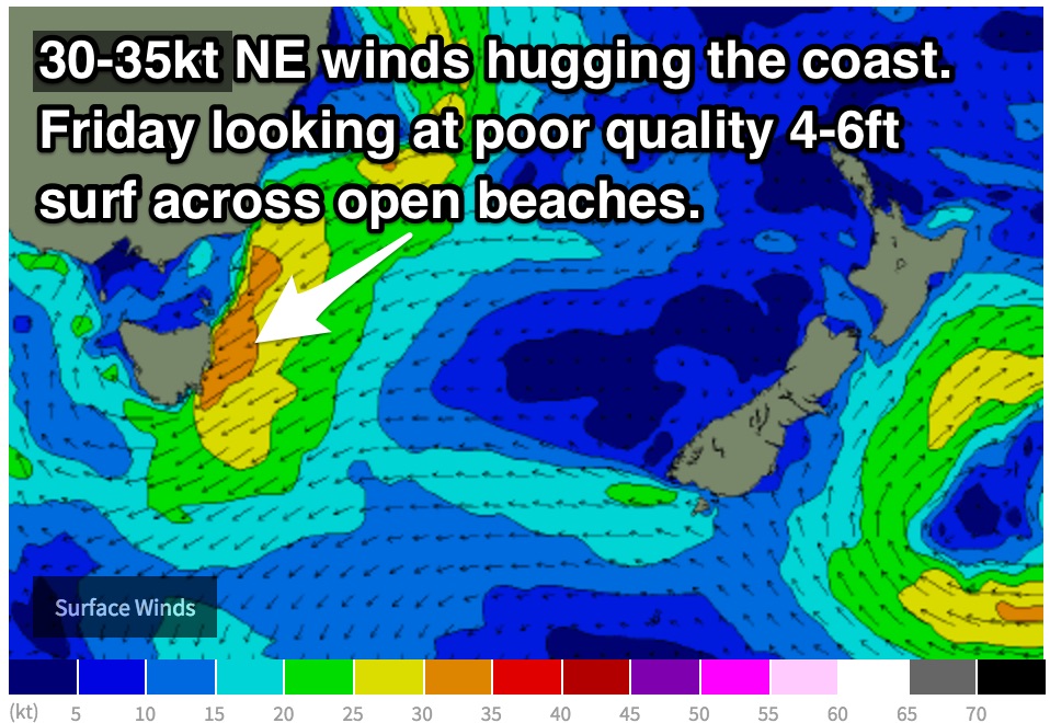
A northeasterly airflow is set to increase as the pressure gradient tightens between this strong ridge and a deep trough moving in from the west.
This northeasterly fetch is due to intensify on Thursday drifting offshore slightly, lacking that close proximity we like to see for rapid swell generation.
As a result, open beaches should build and hold in the 3-4ft range on Thursday.
Also in the mix should be the tail end of east/northeasterly groundswell generated by Ex-Tropical Cyclone Victor. Inconsistent sets in the 2ft range should be breaking across the magnets, fading.
 The morning session looks to offer the cleanest conditions with a light/variable airflow in the morning, tending northeasterly and increasing during the day.
This northeasterly fetch then looks to increase further and push right into the coast core winds of 30-35kts during Friday.
Open beaches are expected to be a wind blown mess, however there will be no shortage of size, with low quality peaking in the 5-6ft+ range.
This weekend (Saturday 30th - Sunday 31st):
Gusty northeasterly breezes looks to back off slightly into Saturday while tending more easterly, maintaining low quality options in the 4-6ft range.
This local swell generator then looks to finally break down, allowing each swell window to become dormant.
The surf across the open beaches will fade through Sunday as a result, easing steadily from the 3ft range.
The quality of the surf show no real sign of improving as gusty onshore breezes continue, however some models suggest Sunday morning may see a window of light northwesterly winds.
At this stage, this scenario remains a low chance as it is highly dependent on the movement of a low pressure system.
Next week (Monday 1st onward):
Hints of residual easterly windswell will continue to break across the open beaches on Monday in the 2ft range early, easing there after.
A light/moderate southeasterly flow should be established by this stage, so protected southern corners of the open beaches may have a small workable wave.
Each swell window then looks to take a break, leading to a few days of tiny conditions with only background energy filling in.
The next best chance of a surfable wave comes on Thursday with the passage of a brisk southerly change.
South facing beaches have the potential to pick up low quality options in the 2ft range in the wake of this gusty change, assuming models agree on the timing during the coming updates.