Pumping waves to end the week

Eastern Tasmania Forecast by Craig Brokensha (issued Wednesday 9th July)
Best Days: Thursday, Friday, Saturday, Sunday morning
Recap
There's been some good waves across the coast the last couple of days as the E'ly swell cleaned up and has held in the 3-4ft range between micro ebbs and pulses. This morning sounded like the best of it with offshore winds and clean lined up conditions. Of much greater importance is tomorrow's large E/NE groundswell, discussed below.
This week and weekend (Jul 9 - 13)
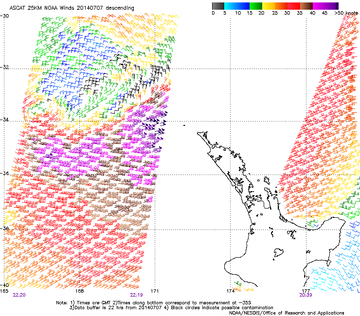
First thing's first, and satellite wind observations have confirmed the formation of a fetch of severe-gale to storm-force E/NE winds off New Zealand's North West Coast yesterday aimed directly towards us.
This is the source of tomorrow's large swell and with everything coming in as expected, there's no change to the forecast size tomorrow, with open beaches along the East Coast due to build strongly during the day to 6ft+.
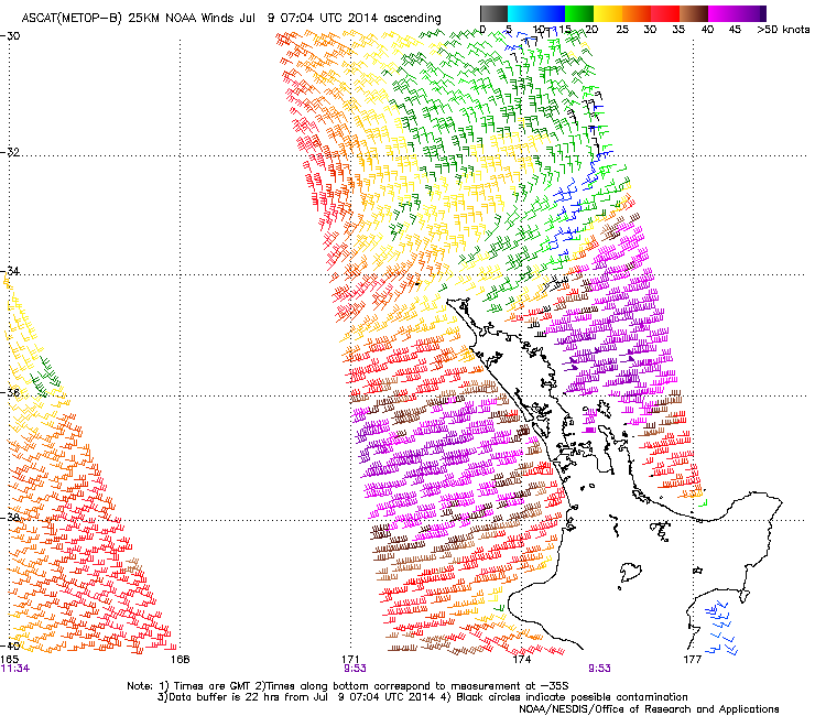
Through today the low has weakened over New Zealand but a fetch of E/NE gales have continued to be aimed towards us, although tomorrow evening we should see this fetch cut off as the system is pushed east by a cold front entering the Tasman Sea.
What this will result in is medium to large levels of E/NE groundswell holding into Friday morning to 4-5ft before backing off slowly through the day and then more noticeably Saturday from 2-3ft+. In saying this Sunday should still offer the odd 1-2ft set but come Monday the swell will be all but gone.
Winds are all we need to work around, and a fresh to strong SW'ly (possibly S/SW at times) will favour protected southern corners and headlands tomorrow as the swell peaks. Friday should see straighter W/NW winds, and then into the weekend weaker W/SW winds are due to persist.
This should create at least 3 full days of pumping surf so I hope you get your fix!
Longer term there's nothing significant until later next week/weekend where the models are picking a deepening surface trough in the Southern Tasman Sea. This is a long way away but if anything transpires it will be from the S/SE and initially stormy. So with that, make the most of the coming days of waves.