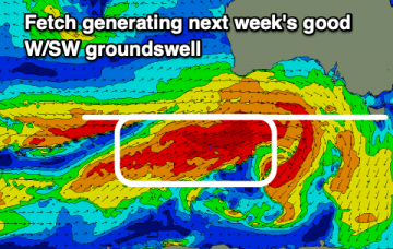
Slow increase in size from Wednesday
Monday, 30 August 2021
Slow increase in size from Wednesday
Monday, 30 August 2021
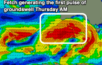
Tiny surf ahead of some building W/SW swell Wednesday afternoon but more so Thursday.
Tiny surf ahead of some building W/SW swell Wednesday afternoon but more so Thursday.
We'll see poor conditions continuing across most regions over the coming days as the swell also grows larger. A slow improvement in conditions is expected from late week and more so on the weekend.
N’ly winds then freshen again Thursday with a much stronger fetch adjacent to the NSW coastline and extending down to the Tasmanian coast brings a stronger flush of NE windswell.
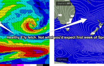
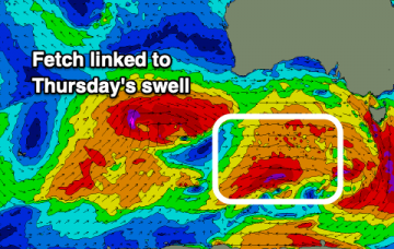
This incredible high pressure system, 1036 and 1042 hPa, then begins to extend a long, broad fetch of SE/ESE winds adjacent to the North Island and extending through the South Pacific and into the Northern Tasman and Southern Coral Sea. This portends another extended E’ly swell event, more focussed on NENSW and SEQLD but with enough width in the fetch to ensure the entire NSW coast gets sprayed with swell from the Eastern Quadrant.
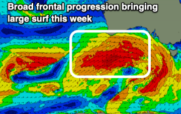
A very active period of surf with building westerly swells over the coming days as winds provide plenty of options for the South Coast and a few windows on the Mid Coast.
The surf will continue to fade into the middle of the week ahead of building surf from the east-northeast on the weekend and more so next week.
Small, slow surf tomorrow with building swell energy from Wednesday as winds favour selected locations for experienced surfers.
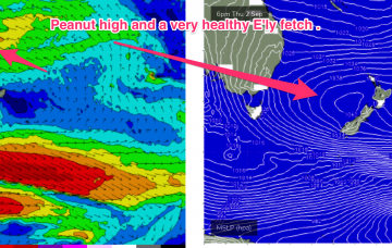
Remnants of this weeks Tasman low are expected to drift NE towards the North Island over the weekend and reintensify Sun/Mon with a fetch of severe gales extending out of Cook Strait into the Tasman Sea.
Tiny beginners waves tomorrow and early next week ahead of some better swell energy mid-late in the week.
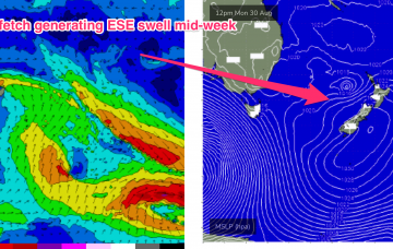
An extended E’ly pattern then sets up, as high pressure straddles New Zealand and the troughy remnants of the Tasman low squeeze pressure gradients along a long, broad fetch extending through the South Pacific adjacent to the North Island and extending into the Coral Sea. Models show this fetch then further retrograding back towards the Australian East Coast to end the working week.