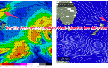
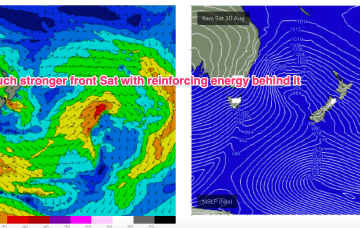
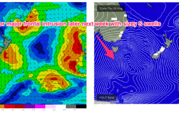
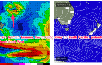
Winds shift W’ly as the initial frontal system sweeps across NSW tomorrow, with a stronger front and low moving up over NSW and then entering the Tasman with a vengeance into the weekend. We’ve still got some E’ly swell inbound from a retreating low which fired up as it approached the North Island.
Primary tabs
/reports/forecaster-notes/south-east-queensland-northern-new-south-wales/2025/08/27/offshores-and-e
freeride76
Wednesday, 27 August 2025
/reports/forecaster-notes/south-east-queensland-northern-new-south-wales/2025/08/25/quality-e-swells
freeride76
Monday, 25 August 2025
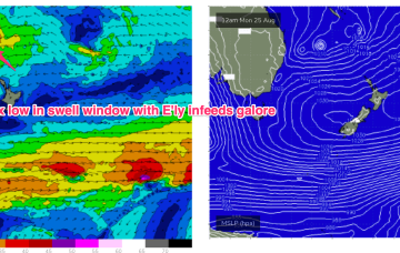
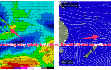
These low centres are focussing areas of E’ly infeed along the trough line- perfectly aimed at east coast targets.
/reports/forecaster-notes/south-east-queensland-northern-new-south-wales/2025/08/22/lots-quality-ely
freeride76
Friday, 22 August 2025
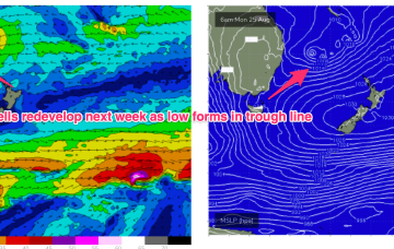
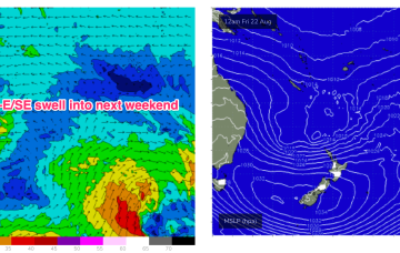
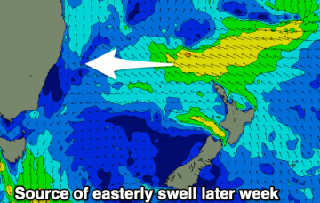
Surf-wise, whatever configuration of low pressure we end up getting, a broad E’ly infeed in the Southern Coral Sea and Northern Tasman will generate plenty of E’ly swell into early-mid week.
/reports/forecaster-notes/south-east-queensland-northern-new-south-wales/2025/08/20/chunky-ely-swells
freeride76
Wednesday, 20 August 2025
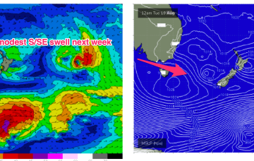
We’ll see the E’ly flow continue to develop in the Northern Tasman and Coral Seas through this week, with swells from that E-NE quadrant building through this short term period under an onshore flow.
/reports/forecaster-notes/south-east-queensland-northern-new-south-wales/2025/08/18/wet-onshore-ely
freeride76
Monday, 18 August 2025
The dominant player is a massive high moving through the Bight and expected to drift over and eastwards of Tasmania tomorrow to occupy the Tasman for most of the week.
/reports/forecaster-notes/south-east-queensland-northern-new-south-wales/2025/08/15/small-clean-e
freeride76
Friday, 15 August 2025
Back to looking dynamic next week. The crux of it is another very strong high moving at Tasmanian latitudes early next week. That will be the anvil for any hammer that forms next week.
/reports/forecaster-notes/south-east-queensland-northern-new-south-wales/2025/08/13/fun-sized-clean
freeride76
Wednesday, 13 August 2025
The fetch responsible for the current E swell is well out in the South Pacific and migrating eastwards with diminishing swells from that source.
/reports/forecaster-notes/south-east-queensland-northern-new-south-wales/2025/08/11/small-fun-e
freeride76
Monday, 11 August 2025
As noted on Fridays forecast another unseasonal low pressure system formed off the QLD coast over the weekend and has now drifted over to a position roughly equidistant between New Caledonia and the North Island.
/reports/forecaster-notes/south-east-queensland-northern-new-south-wales/2025/08/08/workable-windy
thermalben
Friday, 8 August 2025
The weekend won't be perfect but workable across the regions.
/reports/forecaster-notes/south-east-queensland-northern-new-south-wales/2025/08/06/easing-e-swells
freeride76
Wednesday, 6 August 2025
In addition another sub-tropical low is expected to form over the weekend, this time off the QLD coast before drifting off towards the east and reconsolidating near the North Island.