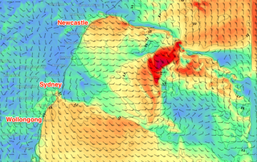
A trough sliding up the coast this afternoon is a bit of an annoyance. It’s both disrupting the northerly fetch generating our local swell (which will lead to a drop in size through Thursday and Friday), and is also steering the Southern Ocean storm track away from our south swell window. It’s also not bringing any local southerly swell either.
Primary tabs
/reports/forecaster-notes/sydney-hunter-illawarra/2018/09/12/average-period-surf-ahead-sunday-biggest
thermalben
Wednesday, 12 September 2018
/reports/forecaster-notes/sydney-hunter-illawarra/2018/09/10/small-windows-opportunity-wide-range
thermalben
Monday, 10 September 2018
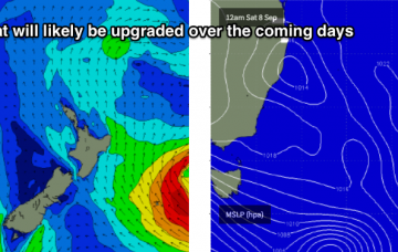
Unfortunately, the synoptic change that brought this initial swell forward has had a negative impact on the short term outlook, as it’s steered some of the trailing systems away from our swell window.
/reports/forecaster-notes/sydney-hunter-illawarra/2018/09/07/complex-outlook-bunch-flukey-swell
thermalben
Friday, 7 September 2018
There’s not a lot of action expected this weekend. And we’ve got a complex wind outlook for Saturday too.
/reports/forecaster-notes/sydney-hunter-illawarra/2018/09/05/complex-period-tricky-troughs-and
thermalben
Wednesday, 5 September 2018
Freshening NE winds will create a few problems throughout Thursday. And it looks like a tricky weekend ahead. Friday morning is your best friend!
/reports/forecaster-notes/sydney-hunter-illawarra/2018/09/03/average-week-surf-ahead-small-windows
thermalben
Monday, 3 September 2018
I’m not too impressed by the coming surf this week.
/reports/forecaster-notes/sydney-hunter-illawarra/2018/08/31/average-weekend-ahead-strong-swells-next
thermalben
Friday, 31 August 2018
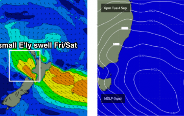
We’ve got a weekend of two halves. And a bucketload of swell on tap for next week.
/reports/forecaster-notes/sydney-hunter-illawarra/2018/08/29/large-easing-swells-thursday-and-bevy
thermalben
Wednesday, 29 August 2018
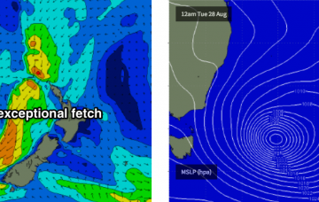
The dropping size will be a little slower than normal because a modest secondary fetch is develop around the (decaying) Tasman Low
/reports/forecaster-notes/sydney-hunter-illawarra/2018/08/27/biggest-swell-winter-inbound
thermalben
Monday, 27 August 2018
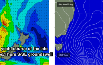
We’ve got some incredible waves ahead.
/reports/forecaster-notes/sydney-hunter-illawarra/2018/08/24/fun-ne-swell-sunday-then-another
thermalben
Friday, 24 August 2018
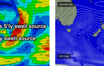
Troughs, fronts and a brand new Tasman Low will generate swells from the NE, S and SE over the forecast period.
/reports/forecaster-notes/sydney-hunter-illawarra/2018/08/22/peaky-options-se-and-ne-generally-good
thermalben
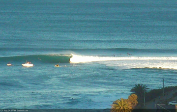
Wednesday, 22 August 2018
During the afternoon, the first in a series of pulses of SE swell will begin to make landfall, originating from a slightly unusual source.