Know Your Product: Real Buoys vs Virtual Buoys

A series in which Swellnet explains surf forecasting information, from the basics to the loftiest of concepts, using simple language and real examples. This week, real buoys vs virtual buoys.
What's the difference between virtual buoys and real buoys? No doubt some people are shaking their heads while reading that question because the answer appears to be so simple. Virtual buoys are virtual, as in they aren't real, take a boat out to the virtual buoy's GPS position and you'll find nothing but empty ocean. However, do the same with a real buoy and you'll bump into a big metal float filled with instruments such as accelerometers that's tethered to the ocean floor.
So now we've got the existential meaning out of the way we can look at each type of product, describe how they work, and assess what's good and bad about them. Buoys – both virtual and real – are critical forecasting tools, so at the end of the process you should have a better understanding of the data and you may even sharpen your own forecasting skills.
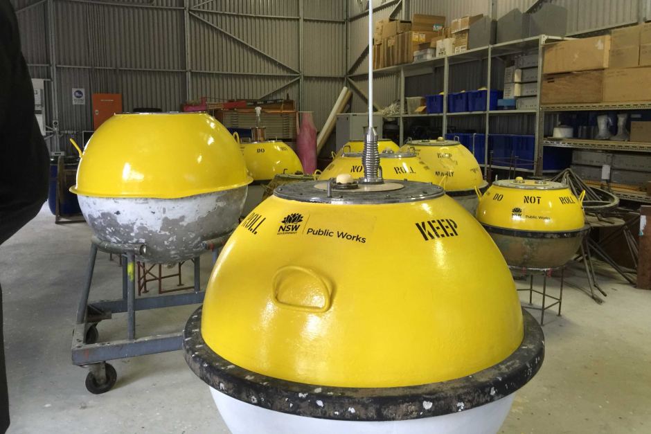
Seven wave buoys waiting to be used by Manly Hydraulic Laboratory
Aside from tangibility, the major difference between the buoys are the types of information they record. Virtual buoys predict virtual information. They predict what a spot of ocean will be doing during a designated point in time. The read out from a virtual buoy will only ever be a prediction and never a measurement. Real buoys, on the other hand, don't predict information, they measure and record what is actually happening.
Therefore, real buoys can only help with current data. Of course they can help estimate swell arrival times, yet everything they record is happening right now. But beware, just because real buoys record real information doesn't mean they're infallible. More on that later.
In contrast, virtual buoys can give both current data and they can peer into the future. They therefore have wider use to forecasters, however users must be aware of their shortcomings.
As mentioned earlier, virtual buoys are a prediction of what a designated spot of ocean will be doing as calculated by an underlying weather model. The information is derived by choosing a GPS co-ordinate somewhere on the ocean's surface.
Some websites allow you to choose a grid point, in that case you need to be aware of the nearby coastal alignment. Is it sheltering the swell? Will you get a true read out? Virtual buoys come into their own when used in the open ocean, they're very good at giving open ocean swell heights and surface conditions where a margin of tolerance is acceptable. Boat captains love them for this reason, yet surfers need to understand their limitations when predicting specific nearshore wave heights.

Coastal alignment and underlying bathymetry can significantly affect approaching swell – a two metre south swell can be 10 foot at a known swell magnet, and just 5 foot down the road - yet virtual buoys rarely take these factors into account. I say 'rarely' because some sites do calibrate their virtual buoys to better reflect local conditions. Hint: we're one of them. Rather than give raw data, we've calibrated every Australian coastline, and many overseas ones, to better reflect how they handle prevailing swell. Click the 'Surf Forecast' tab for any region.
For this reason it's best to use virtual buoys as a guide only. Don't expect exact information, look for trends in the swells – is the swell rising or is it dropping? - and keep in mind there may be a size range between what the virtual buoys say and what actually happens. And just as there may be a size range there may also be a time range – the swell could come earlier or later than predicted.
It's important to note that the further out the prediction is – i.e 12 hours, 48 hours - the less accurate the reading will be. This effect is greatly amplified on east facing coasts because they're traditionally more prone to dynamic weather patterns, and hence swells, than south or west facing coastlines.
Another thing to note is that almost all virtual buoy networks run off the same base information. The only difference between those sites is where they choose the grid points and the website's user experience - some graphs simply look more appealing than others. This is important because aesthetics can effect how you interpret data. Try to see beyond the layout and colours.
When it comes to assessing real time information – i.e what the swell is doing right now – it's always best to seek out a real buoy. As mentioned, virtual buoys run off weather models and those models can be incorrect, sometimes by a little, occasionally by a lot. So if you need the hard facts about swell then track down a real buoy. In Australia, each state government has their own network and some ports have private yet publicly available buoys. See a list below.
Perhaps the most important thing to be aware of when using virtual buoys and real buoys is their capacity to be contaminated by multiple data sets. In simple terms that means they merge information into a graph so it appears as one distinct swell. However, lone swells are rare, more often there are multiple swell trains in the water. Sometimes a long period groundswell will ride underneath a large, short period windswell. When this happens the buoys struggle to resolve the mix and usually output a combination of the swells making it appear larger than reality.
This is a critical error on any coastline susceptible to wind as it skews the data. There's much more to be said on this topic and it deserves to get it's own instalment. Stay tuned next week.
Postscript: To use Swellnet's virtual buoys click the 'Surf Forecast' tab for any region. Rather than give raw data, we've calibrated every Australian coastline, and many overseas ones, to better reflect how they handle prevailing swell.
List of real buoy sites to bookmark:
NSW, Manly Hydraulic Laboratory
Kurnell, NSW Port Authority
Queensland, Queensland Government
Cape Sorell, BoM
Cape du Couedic, BoM
Western Australia, WA Dept of Transport
Previously in Know Your Product:
Wave Period
Comments
It's great that you guys talk about this but please don't give too much away on it. Let the people who just read your forecasts deal with that and let the people who like to catch them sneaky unpredicted swells get them solo sessions.
No probs here....mibs-oner! Oh Buoy Oh Buoy! Blinded by science...So virtual Buoy wants to be a real buoy and the real buoy tells lies. I think I've seen the Disney version. I read it twice and still reckon I'm gonna flunk lesson two. I'm sure Teacher said more much more on this....URGH !!! Surf forcasting was easier in my day...Simply look for bumpy horizon line throw some sand simple chalm to Huey. (Typical old school surfie, I focused more on the cool surf pics). Awesome photo did you see how mixed 360* swell perfectly gently crowns mamma and her baby peaks. That's what the lesson was about....right! Thank Huey for that!
Learn to read a weather map, and get your hands on some good ones!
That's my tip for the day! Apart from ASCAT passes they are closer to first principles information.
Would willyweather be considered a virtual buoy ?
Yes. Any website with automated wave height predictions displayed in a time series graph is a "virtual buoy".
The weather equivalent is a "meteogram".
Interesting. I use willyweather as a cross refrence only for winds as the swell data is shizen. Its also interesting to see the different forecasts on here and willy. Hoping willy gets the one up on this one haha.
As far a i know yes. GFS.
Thermal Ben, Have you guys gone virtual or experimental with your Mornington Peninsula forecasts of late?
Ive followed your website for years and found its accuracy has diminished since the demise of Dan from Peninsula surf. My mates and I were pondering if anyone actually does a swell check anymore or just works on remote modeling.
We haven't tweaked the wave model for Vic in years, and Craig's been doing the written surf forecasts for Vic for the last couple of years too - so nothing has changed at that end.
Errrr! Dolphin ate my homework....but, but,I did watch the news! Big newsweek as little buoys get a dunking by bully typhoon. (WARNING! Not suitable for girly water babies....stop crying!)(NMEFC) National Marine Environmental Forecasting Centre.(Captains log 20:30/14-09-2016) Here are the details of strongest storm on Earth this year.....'China Daily'-Category 5 Super Typhoon MERANTI triggers 17 metre record- high'wave' whipped up by winds of 165 knots. These are highest seas ever recorded offshore China as Typhoon swept across seas 'off' southern coast of Taiwan. Chonglang jijie! Hooroo!
Lost and Found.(update)Super Cells 'Typhoon Meranti's wind-up reaches 300km... spins Moon outta orbit .Best googly of new century,Chinese city clean bowled by The moonball. Blue Planeteers rest their hope on Star import Godzilla knocking Meranti's moonball outta the stratosphere back to whence it came.(Live from South China Sea)"Climate change T 20"Game on!
Friday 10th May'2019 Gold Coast launched "Big Bird"(Buoy)300m off S' Straddie.
Note:(Not to be confused with several near shore Narrowneck/Palm Beach Buoys).
Big Bird is said to be Australia's most technically laden Buoy (Hands off Pirates)
Buoy costs around $160,000 & is part of $1.46m 3yr Commonwealth Grant Trial
Big Bird measures...Weather/Temp/Sediment-Quality/Bed/Currents/Waves/Whales
Essentially a state of the art Coastline planning tool that aims to improve IT data.
CERFS [ Coastal Engineering Research Field Station ]
Qld/Griffith/Newcastle Unis + City of GC-Waterways Authority
https://www.griffith.edu.au/cities-research-institute/griffith-centre-co...
[News Footage]
https://www.facebook.com/9NewsGoldCoast/videos/big-bird/2376994025866835/
[Griffith University 'Big Bird' wrap]
https://app.secure.griffith.edu.au/news/2019/05/10/big-birds-take-off-es...
nice work again tbb.
Waste of money though in my mind. Great for people who don't really use the seaway but looking to study something , The data , I imagine , will be fraught with large error margins, and have little bearing on whats actually happening beyond the breakwall and shorebreaks of the GC. . The local Divers , fishermen , cruise boats , and surfers will collectively always be a better source of info than some anchored bouy being studied by a university mob.
As for data about currents/temps etc go some of us commercial fisho's have been using data loggers on demersal gear for years and uploading it to the Gov. This data comes from multiple locations and from multiple sources.
I,m not completely against the idea of the bouy itself , but unless they invest in a shitload of them , the data , I believe , won't help the GCCC one bit in planning coastal infrastructure. As for climate change stuff , well thats how these things are funded.
'Virtual buoys....predict what a spot of ocean will be doing during a designated point in time'
Clearly not.
Natural to assume constant mega interference corrupts the buoy's vital input data...
Rare big bird habitat could detour the Mayor's cruise ship well out to sea. Bon Voyage!