Mixed bag of southerly swells and southerly winds

Sydney, Hunter and Illawarra Surf Forecast by Ben Matson (issued Friday 20th October)
Best Days: No great days in general but there'll be rideable surf out of the south most days. Sunday morning should have the best conditions, though a little small and gutless in the wave department.
Recap: No shortage of NE swell for the last few days with 3ft+ sets and NE winds for much of Thursday, swinging light offshore this morning before a gusty S’ly change pushed through. We are now seeing building S’ly windswells across the coast in the wake of the change.
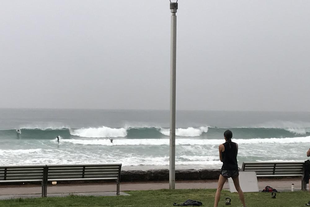
Fun waves across the Manly stretch this morning
This weekend (Oct 21 - Oct 22)
There's no change to the weekend forecast.
Saturday looks a little bleak with persistent, though slowly easing S’ly winds. They’ll remain fresh from Sydney through the Hunter region, but will be lighter south of about Wollongong where there’s a better chance for an early period of SW winds. Elsewhere it’s a low chance; only the Northern Beaches has a possibility to pull a short term rabbit out the hat if we’re very lucky.
Today’s short range windswell will peak overnight and ease throughout the day. South facing beaches should manage 3-4ft sets (bigger in the Hunter) first thing but it’ll be smaller elsewhere around 2ft+ with a mix of swells from the south and E/NE - both swells will however be fading so expect smaller surf into the afternoon.
Sunday is a better choice conditions-wise with early light variable winds, but the swell will be smaller and weaker with an average peaky combo from the E/NE and South; sets to 2ft+ at south facing beaches and smaller elsewhere.
It’ll be worth keeping eye on the coast from about mid-afternoon onwards though. The parent low to today’s change - traversing the waters south of Tasmania right now - is glancing our far southern swell window, generating some small but long period S’ly energy of which the leading edge is due into the Sydney region between 3-6pm.
It’s hard to be confident as to whether we’ll see a decent size increase before the sun goes down (3ft+ sets are likely from this source, though will probably peak overnight… argh!) but it will be worth monitoring the wave buoys across Southern NSW during the afternoon to detect its arrival. Winds may swing to a light to moderate onshore around this time too so don't expect great conditions.
Next week (Oct 23 onwards)
Sunday’s late S’ly swell will ease slightly but hold into Monday with inconsistent 2-3ft sets at south facing beaches, smaller elsewhere but slightly larger across the Hunter near 4ft.
It’ll be supplemented by a secondary short range S’ly swell, originating from a front crossing the Tasmanian region later Saturday, driving SW gales east from Bass Strait during Sunday. They’ll contribute a slightly smaller amount of size to the region on Monday, which should fill in the gaps.
Unfortunately, this same frontal system is expected to impact the Sydney/Hunter/Illawarra coasts in the early hours of Monday morning. It should ease rapidly throughout the day to become light and variable by the afternoon, but we are at risk of a lingering S’ly breeze early morning, especially across the Hunter region.
This southerly swell combo will then ease from Tuesday with NE winds freshening across the region. A small NE windswell is possible later Tuesday and (at a pinch) early Wednesday though it won't be very big nor very strong.
Elsewhere, and there are no other notable, confident swell sources for the long term period.
The troughy system modelled for the Northern Tasman Sea early next week doesn’t look very well aligned for us (and will transition quickly through the swell window anyway), and a series of polar lows skirting the ice shelf south of the Tasman Sea from Sunday onwards will be too small in size and too far from the mainland (and too poorly aligned) to generate anything meaningful for our region. A small S/SE swell is possible later in the week or early next weekend, but it’s not worth working around.
I will however be keeping an eye on a modelled coastal trough expected off the Southern NSW coast around Thursday, which has the potential to develop into a closed system, or possibly an East Coast Low. It’s a long time away but next Friday and Saturday are certainly on the cards for a punchy local swell event. More on this in Monday’s update.
Have a great weekend!