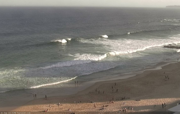
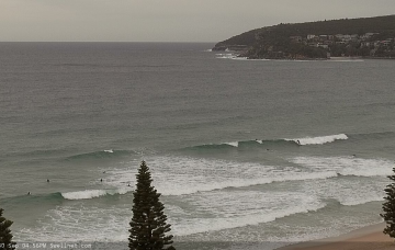
Model guidance actually suggest tomorrow will be bigger than today. But, I just can’t see Thursday bombing any higher. More in the Forecaster Notes.
Primary tabs
/reports/forecaster-notes/sydney-hunter-illawarra/2020/10/07/slowly-easing-back-spell-quieter-energy
thermalben
Wednesday, 7 October 2020
/reports/forecaster-notes/sydney-hunter-illawarra/2020/10/05/coupla-unreal-days-waves-ahead
thermalben
Monday, 5 October 2020
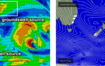
The main feature on the charts right now is an easterly dip in the north-eastern Tasman Sea, midway between New Caledonian and Fijian longitudes. More in the Forecaster Notes.
/reports/forecaster-notes/sydney-hunter-illawarra/2020/10/02/heck-lot-swell-sources-consider
thermalben
Friday, 2 October 2020
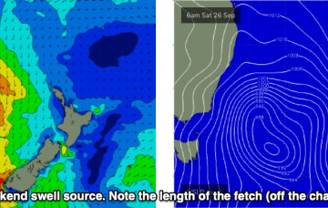
Over the weekend, a deep trough is expected to form south of Fiji, and a supporting ridge to the south will enhance a broad easterly fetch through the north-eastern Tasman Sea, stretching out into the Coral Sea. More in the Forecaster Notes.
/reports/forecaster-notes/sydney-hunter-illawarra/2020/09/30/wide-range-active-swell-sources
thermalben
Wednesday, 30 September 2020
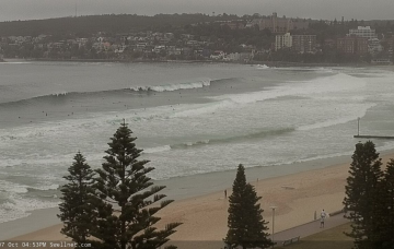
This afternoon’s local NE windswell should hang around into Thursday morning, but ultimately it’s the S/SE groundswell we’re all hanging out for. More in the Forecaster Notes.
/reports/forecaster-notes/sydney-hunter-illawarra/2020/09/28/strong-the-south-tending-sou-sou-east
thermalben
Monday, 28 September 2020
Ultimately, there’s no major change to this week’s forecast, as was issued on Friday. More in the Forecaster Notes.

/reports/forecaster-notes/sydney-hunter-illawarra/2020/09/25/extended-run-strong-long-period-south
thermalben
Friday, 25 September 2020
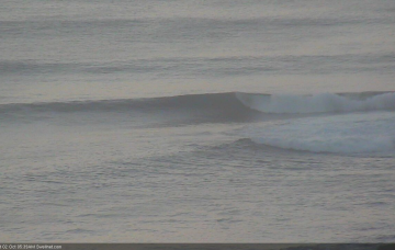
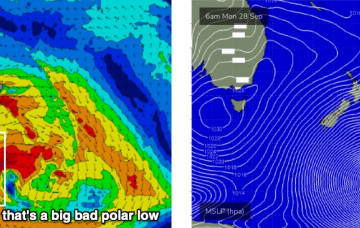
The parent polar low to the upcoming frontal sequence will stall south of New Zealand over the weekend, evolving into one of the biggest, most impressive weather systems seen in this region in a very long time. More in the Forecaster Notes.

/reports/forecaster-notes/sydney-hunter-illawarra/2020/09/23/lots-southerly-swell-ahead
thermalben
Wednesday, 23 September 2020
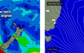
The models have changed the structure and evolution of a deep Tasman Low that’s expected to form east of the South Coast on Saturday morning. But despite the slight downgrade in the model guidance, I actually prefer the progged evolution. More in the Forecaster Notes.
/reports/forecaster-notes/sydney-hunter-illawarra/2020/09/21/small-pickings-week-ahead-large-sly
thermalben
Monday, 21 September 2020
A Tasman Low is expected to rapidly intensify off the Southern NSW coast on Saturday morning. More in the Forecaster Notes.
/reports/forecaster-notes/sydney-hunter-illawarra/2020/09/18/pockets-opportunities-mix-swells
thermalben
Friday, 18 September 2020
A broad polar low/front below the continent mid-week has generated a strong new southerly groundswell that will bend up and into the Southern NSW coast. More in the Forecaster Notes.
/reports/forecaster-notes/sydney-hunter-illawarra/2020/09/16/complex-mix-swells-the-south-and-north
thermalben
Wednesday, 16 September 2020
Actually, we have four, almost five more days of flukey long period southerly swell on the way. More in the Forecaster Notes.